|
search place name
|
||
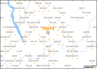
Pokpa (Sagaing, Myanmar)Pokpa is a town in the Sagaing region of Myanmar. An overview map of the region around Pokpa is displayed below.
regional and 3d topo map of Pokpa, Myanmar ::
Pokpa airports ::
The nearest airport is MDL - Mandalay Intl, located 142.3 km south of Pokpa.
Other airports nearby include IMF - Imphal (265.4 km north west), Nearby towns ::
Thabyetha (1.9km south) //
Zigon (2.5km south west) //
Bonmyo (2.5km south east) //
Minba (2.5km north west) //
Yingaukkon (2.5km north west) //
Pyidaw (2.5km north east) //
Thabeikhmauk (3.4km west) //
Tantabin (3.4km east) //
Nyaunggaing (3.7km north) //
Ywathit (4.1km south west) //
Taungshe (3.9km south west) //
Chaunggan (3.9km north east) //
Minywa (4.1km north east) //
Aingya (5.0km south east) //
Ta-naunggaing (5.1km east) //
Zibyugon (5.6km north) //
Sizongyi (5.6km south) //
Hnedwin (5.6km south) //
Mo-nat (5.6km south) //
Ledok (5.8km south) //
Bidaukkon (5.8km south) //
Gwegon (5.4km east) //
Ngayanè (5.4km west) //
Yaukthingan (6.3km south east) //
Thayetkaung (6.5km north west) //
Wetto (6.3km south west) //
Sinnin (6.5km north east) //
Zadi (6.3km north east) //
Palangyaing (6.3km north west) //
[all distances 'as the bird flies' and approximate] 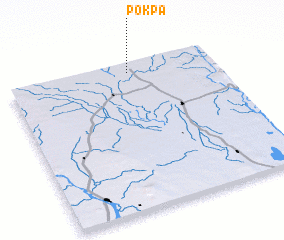 Places with similar names to Pokpa, Myanmar ::
Disclaimer :: Information on this page comes without warranty of any kind |
||
|
Where is Pokpa? Elevation and coordinates ::
Latitude (lat): 22°56'0"N Longitude (lon): 95°35'0"E
Elevation (approx.): 134m (map arrows pan, magnifying glasses zoom) |
||
|
Visiting Pokpa? Hotel/Accommodation ::
Book a hotel in Pokpa Travel Guide ::
Buy a travel guide for Myanmar rental cars ::
car rental offers GPS waypoint ::
download a GPX waypoint (PoI) of Pokpa for your GPS receiver
|
||