|
search place name
|
||
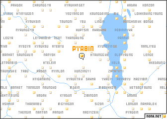
Pyabin (Shan, Myanmar)Pyabin is a town in the Shan region of Myanmar. An overview map of the region around Pyabin is displayed below.
regional and 3d topo map of Pyabin, Myanmar ::
Pyabin airports ::
The nearest airport is HEH - Heho, located 26.2 km north of Pyabin.
Other airports nearby include MDL - Mandalay Intl (159.5 km north west), Nearby towns ::
Taungbogyi (1.9km south) //
Tonle (1.9km south) //
Thabyebin (2.5km north east) //
Htaunggwe (3.5km east) //
Kunzingyi (3.7km south) //
Thandaung (4.1km north west) //
Taungbya (4.1km south west) //
Huptsin (5.6km north) //
Ngapegyaung (5.2km east) //
Myebyu (5.5km west) //
Kyungyi-nge (5.5km east) //
Kyauktaw (5.8km south) //
Taunggya (5.8km north) //
Sawma (5.8km south) //
Ngot (6.4km north west) //
Nwadama (6.6km north east) //
Mingyaung (6.4km north east) //
Myinlon (6.4km south west) //
Thale (6.4km south east) //
Ywama (6.4km south east) //
Ye-u (7.4km north) //
Miyanzin (6.9km west) //
Nadaunggya (7.4km south) //
Nanyok (6.9km west) //
Kanywa (7.6km north) //
Indein (7.6km south) //
Htelein (7.2km west) //
Kela (7.2km east) //
Ywagyi (7.6km south east) //
[all distances 'as the bird flies' and approximate] 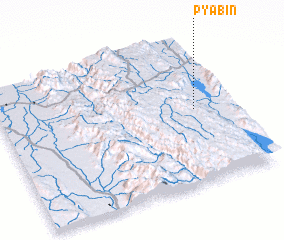 Places with similar names to Pyabin, Myanmar ::
Disclaimer :: Information on this page comes without warranty of any kind |
||
|
Where is Pyabin? Elevation and coordinates ::
Latitude (lat): 20°31'0"N Longitude (lon): 96°51'0"E
Elevation (approx.): 889m (map arrows pan, magnifying glasses zoom) |
||
|
Visiting Pyabin? Hotel/Accommodation ::
Book a hotel in Pyabin Travel Guide ::
Buy a travel guide for Myanmar rental cars ::
car rental offers GPS waypoint ::
download a GPX waypoint (PoI) of Pyabin for your GPS receiver
|
||