|
search place name
|
||
Pyinghaw (Shan, Myanmar)Pyinghaw is a town in the Shan region of Myanmar. An overview map of the region around Pyinghaw is displayed below.
regional and 3d topo map of Pyinghaw, Myanmar ::

Pyinghaw airports ::
The nearest airport is LSH - Lashio, located 116.9 km west of Pyinghaw.
Nearby towns ::
Mān Ye-su (1.9km north) //
Sinchai (2.5km north east) //
Pangkawp (4.1km north west) //
A-hu-chai (4.1km south west) //
Wotaohaw (3.9km south east) //
Mān Mong Hum (5.0km north west) //
Hpa-kuttao (5.0km south east) //
Mafangchai (6.5km south west) //
Hpa-lieng (6.5km north west) //
Lu-fang (6.3km south east) //
Hsinohai (6.3km south west) //
Kye-panlawhe (6.3km south west) //
Kawngshan (7.4km north) //
Mān Mong Kun (6.8km west) //
Konglong (7.4km south) //
Nammu (7.6km south) //
Taolu (7.5km south east) //
Mān Kang (8.2km north east) //
Taklu (8.2km north east) //
Akwe-chai (7.8km south west) //
Hsi-hpa-chai (8.2km south west) //
Hpa-kyut (8.8km north west) //
Ho-loi (9.0km south east) //
Pang Long (9.0km south west) //
Ho-namtap (10.1km north east) //
Chamaw (10.1km south west) //
[all distances 'as the bird flies' and approximate] 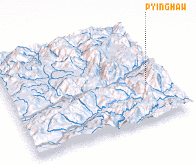 Places with similar names to Pyinghaw, Myanmar ::
Disclaimer :: Information on this page comes without warranty of any kind |
||
|
Where is Pyinghaw? Elevation and coordinates ::
Latitude (lat): 23°19'0"N Longitude (lon): 98°50'0"E
Elevation (approx.): 1446m (map arrows pan, magnifying glasses zoom) |
||
|
Visiting Pyinghaw? Hotel/Accommodation ::
Book a hotel in Pyinghaw Travel Guide ::
Buy a travel guide for Myanmar rental cars ::
car rental offers GPS waypoint ::
download a GPX waypoint (PoI) of Pyinghaw for your GPS receiver
|
||