|
search place name
|
||
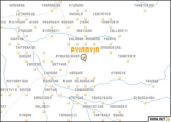
Pyinnyin (Myanmar)Pyinnyin is a town in Myanmar. An overview map of the region around Pyinnyin is displayed below.
regional and 3d topo map of Pyinnyin, Myanmar ::
Pyinnyin airports ::
The nearest airport is HEH - Heho, located 155.9 km north east of Pyinnyin.
Other airports nearby include MDL - Mandalay Intl (203.4 km north), SNW - Thandwe (209.9 km south west), Nearby towns ::
Gônbin (1.9km north) //
Thegaw (2.5km north east) //
Kanbegyi (2.5km north east) //
Pyaukseikkon (3.5km west) //
Tanbingôn (3.7km south) //
Simidungyi (3.7km north) //
Kandwin (4.1km south west) //
Kalagan (4.1km north west) //
Pyunwagyi (4.1km south east) //
Pindaing (4.1km north east) //
Chaungnet (5.1km north west) //
Milaunggôn (5.6km south) //
Magyigôn (5.6km north) //
Ywamana (5.6km north) //
Sittha (5.8km south) //
Satthwa (5.5km west) //
Mezaligôn (5.8km south) //
Kinmundaung (5.5km east) //
Inwun (6.6km south west) //
Thebyu (6.4km north east) //
Thibinwaing (7.4km south) //
Nyaunggôn (7.0km west) //
Zidaw (7.4km north) //
Myogaing (7.6km south) //
Kyangya (7.9km south east) //
Chingôn (7.9km south west) //
Gônnyindan (7.9km south east) //
Bôngôn (8.2km north west) //
Thayetsu (8.2km north west) //
[all distances 'as the bird flies' and approximate] 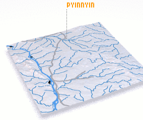 Places with similar names to Pyinnyin, Myanmar ::
// Pyinnyin (MM)
Disclaimer :: Information on this page comes without warranty of any kind |
||
|
Where is Pyinnyin? Elevation and coordinates ::
Latitude (lat): 19°54'0"N Longitude (lon): 95°36'0"E
Elevation (approx.): 165m (map arrows pan, magnifying glasses zoom) |
||
|
Visiting Pyinnyin? Hotel/Accommodation ::
Book a hotel in Pyinnyin Travel Guide ::
Buy a travel guide for Myanmar rental cars ::
car rental offers GPS waypoint ::
download a GPX waypoint (PoI) of Pyinnyin for your GPS receiver
|
||