|
search place name
|
||
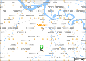
Saga-in (Sagaing, Myanmar)Saga-in is a town in the Sagaing region of Myanmar. An overview map of the region around Saga-in is displayed below.
regional and 3d topo map of Saga-in, Myanmar ::
Saga-in airports ::
The nearest airport is MDL - Mandalay Intl, located 7.2 km south of Saga-in.
Other airports nearby include HEH - Heho (140.7 km south east), LSH - Lashio (226.2 km north east), Nearby towns ::
Sagainpanya (2.5km north west) //
Tabetswe (2.5km north east) //
Panya (3.7km north) //
Myedaw (3.7km north) //
Themaunggan (3.7km south) //
Kanlu (3.4km east) //
Thangedaw (3.9km north west) //
Ashe Wunbade (4.1km south east) //
Ywadaw (3.9km south east) //
Inya (5.1km south west) //
Kyaunggyikan (5.1km south west) //
Banaw (5.1km north east) //
Anauk Wunbade (5.1km south east) //
Wunbade (5.1km south east) //
Htandaw (5.1km south east) //
Zichaung (5.2km west) //
Letpanchaing (5.2km east) //
Hmawgun (5.6km north) //
Ywathit (5.5km east) //
Tada-u (5.8km north) //
Nwakyawda (5.8km north) //
Thinban (6.5km north west) //
Wuntho (6.4km south east) //
Sawye (6.5km south east) //
Zegyi (7.4km north) //
Zibin (7.6km north) //
Yelungyaw (7.6km north) //
Kyigon (7.1km east) //
Shwebawgyun (7.6km south) //
[all distances 'as the bird flies' and approximate]  Places with similar names to Saga-in, Myanmar ::
Disclaimer :: Information on this page comes without warranty of any kind |
||
|
Where is Saga-in? Elevation and coordinates ::
Latitude (lat): 21°46'0"N Longitude (lon): 95°59'0"E
Elevation (approx.): 71m (map arrows pan, magnifying glasses zoom) |
||
|
Visiting Saga-in? Hotel/Accommodation ::
Book a hotel in Saga-in Travel Guide ::
Buy a travel guide for Myanmar rental cars ::
car rental offers GPS waypoint ::
download a GPX waypoint (PoI) of Saga-in for your GPS receiver
|
||