|
search place name
|
||
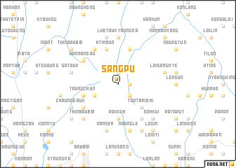
Sangpu (Shan, Myanmar)Sangpu is a town in the Shan region of Myanmar. An overview map of the region around Sangpu is displayed below.
regional and 3d topo map of Sangpu, Myanmar ::
Sangpu airports ::
The nearest airport is HEH - Heho, located 34.7 km south west of Sangpu.
Other airports nearby include MDL - Mandalay Intl (145.1 km north west), Nearby towns ::
Tunmakmōn (1.7km east) //
Nyawngkon (1.7km east) //
Um-asa-hti (1.7km east) //
Uma-ywama (1.7km east) //
Longhi-pe (1.9km north) //
Nam-tapai (2.5km south east) //
Na-kan (3.9km south west) //
Ton-ta-pio-mi (5.1km south east) //
Pakkum (5.6km south) //
Hti-mawn (5.8km north) //
Taunggya (5.8km north) //
Tawngchun (5.5km west) //
Cho-noi (6.5km north west) //
Pawmu-ywama (6.4km south west) //
Wān Mansaw (6.4km north west) //
Panting (6.6km south east) //
Lwetaw Kyaungna (7.4km north) //
Sa-tawk (7.2km west) //
Namsem (7.6km south) //
Hsa-lai (7.6km north) //
Nawngle (7.6km south) //
Loi-sang-mye (7.2km east) //
Sa-hkwi (7.6km south east) //
Re-piu (7.6km south east) //
Thinbawbin (7.6km south west) //
Munping (7.6km south west) //
Wetyok (7.9km south west) //
Chaunggauk (7.9km south west) //
Loi Leng (8.2km south east) //
[all distances 'as the bird flies' and approximate]  Places with similar names to Sangpu, Myanmar ::
// Saungpe (MM)
// Suangpi (MM)
// Suang Pai (MY)
// San Iacopo (IT)
// Snaigupė (LT)
// Singpa (BD)
// Zinkpè (BJ)
// Zounkpé (BJ)
// Songopaï (CF)
// Sungai Ipuh (ID)
Disclaimer :: Information on this page comes without warranty of any kind |
||
|
Where is Sangpu? Elevation and coordinates ::
Latitude (lat): 20°54'0"N Longitude (lon): 97°5'0"E
Elevation (approx.): 1433m (map arrows pan, magnifying glasses zoom) |
||
|
Visiting Sangpu? Hotel/Accommodation ::
Book a hotel in Sangpu Travel Guide ::
Buy a travel guide for Myanmar rental cars ::
car rental offers GPS waypoint ::
download a GPX waypoint (PoI) of Sangpu for your GPS receiver
|
||