|
search place name
|
||
Sizongon (Myanmar)Sizongon is a town in Myanmar. An overview map of the region around Sizongon is displayed below.
regional and 3d topo map of Sizongon, Myanmar ::

Sizongon airports ::
The nearest airport is RGN - Yangon Intl, located 208.9 km south of Sizongon.
Other airports nearby include HEH - Heho (222.3 km north), Nearby towns ::
Segingyi (1.8km east) //
Kyauktalin (1.8km east) //
Thayettaw (2.6km north west) //
Kwinywa (2.6km north east) //
Taungnyo (3.5km east) //
Paukkon (3.7km north) //
Pinya (3.7km north) //
Wetkon (4.0km south east) //
Milaunggon (4.0km south east) //
Shanzu (4.0km south east) //
Kanhledaw (4.0km south east) //
Taungudaw (4.0km north west) //
Hlezu (4.1km north east) //
Hngetpyawdaw (5.1km south east) //
Bon (5.1km north west) //
Letsutkya (5.1km north east) //
Bawdigon (5.6km north) //
Daungthaik (5.6km north) //
Indaing (5.3km east) //
Singyi (5.8km north) //
Yetho (5.8km north) //
Thanbo (5.8km north) //
Tegyigon (5.6km east) //
Yetho (6.6km south east) //
Singondaing (6.6km north east) //
Thandaingkhin (7.0km east) //
Wetkon (7.4km north) //
Sibin (7.6km south) //
Kyatpyin (7.6km south) //
[all distances 'as the bird flies' and approximate] 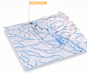 Places with similar names to Sizongon, Myanmar ::
Disclaimer :: Information on this page comes without warranty of any kind |
||
|
Where is Sizongon? Elevation and coordinates ::
Latitude (lat): 18°47'0"N Longitude (lon): 96°21'0"E
Elevation (approx.): 55m (map arrows pan, magnifying glasses zoom) |
||
|
Visiting Sizongon? Hotel/Accommodation ::
Book a hotel in Sizongon Travel Guide ::
Buy a travel guide for Myanmar rental cars ::
car rental offers GPS waypoint ::
download a GPX waypoint (PoI) of Sizongon for your GPS receiver
|
||