|
search place name
|
||
Tabogyo (Myanmar)Tabogyo is a town in Myanmar. An overview map of the region around Tabogyo is displayed below.
regional and 3d topo map of Tabogyo, Myanmar ::

Tabogyo airports ::
The nearest airport is SNW - Thandwe, located 164.9 km south west of Tabogyo.
Other airports nearby include HEH - Heho (204.9 km north east), Nearby towns ::
Putchidu (1.9km north) //
Sakangyi (1.7km east) //
Eingyigon (1.9km south) //
Inle (2.5km south east) //
Kayinsan (2.5km south west) //
Myomi (4.1km south west) //
Yedin (5.1km south east) //
Magyizin (5.2km west) //
U-yin (5.2km east) //
Mindègon Te (5.6km west) //
Gyogyagon (5.6km west) //
Natmauk (5.8km south) //
Thayetchaung (6.4km north east) //
Tubauk (6.6km south east) //
Kodaung (6.6km north east) //
Kyaukpyokkon (6.6km south west) //
Peinin (6.6km north west) //
Gwegyo (6.6km north west) //
Shwebandaw (6.4km south west) //
Tongyo (7.4km north) //
Thapanzan (7.4km south) //
Hainggyido (7.0km west) //
Pyaungthe (7.2km east) //
Kyudaw (7.6km south west) //
Thitnyo (7.6km south east) //
Tagundaing (7.9km south east) //
Swedon (8.2km south east) //
Baye (7.9km south west) //
Zein (7.9km south west) //
[all distances 'as the bird flies' and approximate] 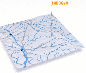 Places with similar names to Tabogyo, Myanmar ::
// Ţubayjīyah (SY)
// Tobgyai (CN)
Disclaimer :: Information on this page comes without warranty of any kind |
||
|
Where is Tabogyo? Elevation and coordinates ::
Latitude (lat): 19°16'0"N Longitude (lon): 95°37'0"E
Elevation (approx.): 171m (map arrows pan, magnifying glasses zoom) |
||
|
Visiting Tabogyo? Hotel/Accommodation ::
Book a hotel in Tabogyo Travel Guide ::
Buy a travel guide for Myanmar rental cars ::
car rental offers GPS waypoint ::
download a GPX waypoint (PoI) of Tabogyo for your GPS receiver
|
||