|
search place name
|
||
Tanaungbinle (Mandalay, Myanmar)Tanaungbinle is a town in the Mandalay region of Myanmar. An overview map of the region around Tanaungbinle is displayed below.
regional and 3d topo map of Tanaungbinle, Myanmar ::

Tanaungbinle airports ::
The nearest airport is MDL - Mandalay Intl, located 47.7 km north east of Tanaungbinle.
Other airports nearby include HEH - Heho (139.0 km south east), Nearby towns ::
Natogyi (1.9km north) //
Nyaunggon (1.7km west) //
Kanywa (2.5km north west) //
Magyigan (3.7km south) //
Tazin (3.9km north east) //
Mogan (4.1km north west) //
Aungbangon (5.6km south) //
Buthigyin (5.6km north) //
Tanbindaw (5.2km west) //
Thaminbe (6.5km north east) //
Shawbyu (6.4km north west) //
Palangon (7.4km south) //
Kyabwa (7.4km south) //
Thama (6.9km west) //
Lanlegwa (7.6km south) //
Payagyi (7.1km east) //
Tandawma (7.1km west) //
Gwegon (7.1km west) //
Nyaungbinzauk (7.1km east) //
Kyagan (7.6km north) //
Gwebintha (7.6km north east) //
Shawbyu (7.6km north west) //
Segale (7.8km south west) //
Thayagon (7.8km north west) //
Tangwa (7.8km north east) //
Kyaungnan (8.9km north west) //
Bugaing (9.0km north west) //
Mannaingtha (10.1km south east) //
[all distances 'as the bird flies' and approximate] 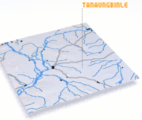 Places with similar names to Tanaungbinle, Myanmar ::
// Tanaungbinhla (MM)
Disclaimer :: Information on this page comes without warranty of any kind |
||
|
Where is Tanaungbinle? Elevation and coordinates ::
Latitude (lat): 21°24'0"N Longitude (lon): 95°39'0"E
Elevation (approx.): 223m (map arrows pan, magnifying glasses zoom) |
||
|
Visiting Tanaungbinle? Hotel/Accommodation ::
Book a hotel in Tanaungbinle Travel Guide ::
Buy a travel guide for Myanmar rental cars ::
car rental offers GPS waypoint ::
download a GPX waypoint (PoI) of Tanaungbinle for your GPS receiver
|
||