|
search place name
|
||
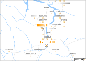
Taungtin (Myanmar)Taungtin is a town in Myanmar. An overview map of the region around Taungtin is displayed below.
regional and 3d topo map of Taungtin, Myanmar ::
Taungtin airports ::
The nearest airport is MGZ - Myeik, located 112.9 km north of Taungtin.
Other airports nearby include HHQ - Prachuap Khiri Khan Hua Hin (165.5 km north east), Nearby towns ::
Taungyaung (1.9km south) //
Htong-yaik (1.9km north) //
Lenya (2.6km south east) //
Taungpyu (3.7km south) //
Kankhpan (3.7km north) //
Taungkup (3.6km east) //
Ban Kala (4.1km south east) //
Dukanum (4.1km south east) //
Yinba (4.1km north east) //
Taungkahan (5.2km south east) //
Ngwa-la-me (5.6km north) //
Chaungchan (5.8km east) //
Lampon (6.6km north west) //
Hengrai (7.6km south) //
Taungtin (7.6km south) //
Taungkasi (8.3km north east) //
Wetto (8.3km north east) //
Chaungnyiko (9.1km north east) //
Nat-taung (10.4km north east) //
[all distances 'as the bird flies' and approximate] 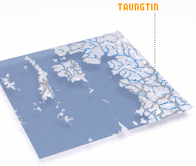 Places with similar names to Taungtin, Myanmar ::
// Dinaguitan (PH)
// Taungdan (MM)
// Taungdin (MM)
// Taungdun (MM)
// Taunggadon (MM)
// Taungtin (MM)
// Dingden (DE)
// Tinguatón (ES)
// Tangoden (BF)
// Tancuitín (MX)
Disclaimer :: Information on this page comes without warranty of any kind |
||
|
Where is Taungtin? Elevation and coordinates ::
Latitude (lat): 11°29'0"N Longitude (lon): 98°59'0"E
Elevation (approx.): 10m (map arrows pan, magnifying glasses zoom) |
||
|
Visiting Taungtin? Hotel/Accommodation ::
Book a hotel in Taungtin Travel Guide ::
Buy a travel guide for Myanmar rental cars ::
car rental offers GPS waypoint ::
download a GPX waypoint (PoI) of Taungtin for your GPS receiver
|
||