|
search place name
|
||
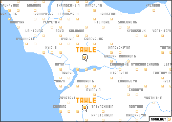
Tawle (Rakhine, Myanmar)Tawle is a town in the Rakhine region of Myanmar. An overview map of the region around Tawle is displayed below.
regional and 3d topo map of Tawle, Myanmar ::
Tawle airports ::
The nearest airport is KYP - Kyaukpyu, located 37.7 km north west of Tawle.
Other airports nearby include SNW - Thandwe (96.6 km south east), AKY - Sittwe (141.7 km north west), Nearby towns ::
Kanyingauk (1.9km south) //
Kalangyan (2.5km south east) //
Awabyin (2.5km south west) //
Gangyaung (4.1km north east) //
Yemyet (4.1km north west) //
Tazaung (4.1km north west) //
Tawbyin (5.1km south west) //
Kyalwin (5.1km north west) //
Gangaw (5.3km east) //
Thanwara (5.3km east) //
Konbaung (5.6km south) //
Minbyin (5.6km north) //
Yechangyi (5.6km north) //
Atwinbyin (5.8km south) //
Mayin (5.6km west) //
Ponsobyin (5.6km east) //
Kaladwin (5.8km north) //
Ziyin (5.8km south) //
Salihbaw (5.8km south) //
Tabet (5.6km west) //
Zabyi (6.4km south east) //
Pyunkhaung (6.4km south west) //
Ngāmeye (6.4km north east) //
Thabyeseik (6.6km south west) //
Chaungbya (6.4km north west) //
Paukpyin (7.4km north) //
Pyagyi (7.2km east) //
Chaungbwe (7.2km east) //
Pyinnyin (7.6km south) //
[all distances 'as the bird flies' and approximate] 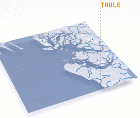 Places with similar names to Tawle, Myanmar ::
Disclaimer :: Information on this page comes without warranty of any kind |
||
|
Where is Tawle? Elevation and coordinates ::
Latitude (lat): 19°8'0"N Longitude (lon): 93°43'0"E
Elevation (approx.): 67m (map arrows pan, magnifying glasses zoom) |
||
|
Visiting Tawle? Hotel/Accommodation ::
Book a hotel in Tawle Travel Guide ::
Buy a travel guide for Myanmar rental cars ::
car rental offers GPS waypoint ::
download a GPX waypoint (PoI) of Tawle for your GPS receiver
|
||