|
search place name
|
||
Tawnghtek (Shan, Myanmar)Tawnghtek is a town in the Shan region of Myanmar. An overview map of the region around Tawnghtek is displayed below.
regional and 3d topo map of Tawnghtek, Myanmar ::

Tawnghtek airports ::
The nearest airport is LSH - Lashio, located 97.1 km north east of Tawnghtek.
Other airports nearby include MDL - Mandalay Intl (140.8 km south west), HEH - Heho (173.5 km south), Nearby towns ::
Kawngtōng (1.9km north) //
Nawngmawn (3.4km east) //
Namhsawnghko (3.4km west) //
Penghtawn (3.9km north west) //
Nawngmawn (3.9km south east) //
Pakang (3.9km south east) //
Mānhtinloi (4.1km north east) //
Mānloihai (4.1km north east) //
Köngpau (4.1km south east) //
Nawnghsām (5.0km north east) //
Nalin (5.0km north west) //
Pāngkauk (5.1km east) //
Pāteng (5.6km south) //
Mānti (5.1km west) //
Kongsong (5.1km east) //
Namhkio (5.6km north) //
Pawk-āng (5.6km north) //
Honam (5.5km east) //
Tahawm (5.8km south) //
Nawngpawkwi (5.8km south) //
Hpāktup (6.5km north east) //
Hāngnawng (6.3km north west) //
Kyaungpōngwo (6.5km north west) //
Pongwo (6.5km north west) //
Nawngyāng (7.6km north) //
Köng-ai (7.1km east) //
Namhsawnghko (7.1km west) //
Man Htam (7.1km west) //
Hkaihsān (7.1km east) //
[all distances 'as the bird flies' and approximate] 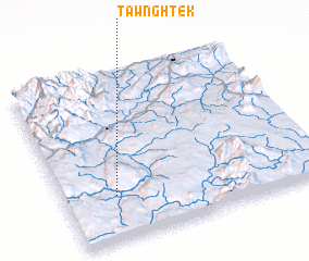
Disclaimer :: Information on this page comes without warranty of any kind |
||
|
Where is Tawnghtek? Elevation and coordinates ::
Latitude (lat): 22°16'0"N Longitude (lon): 97°12'0"E
Elevation (approx.): 906m (map arrows pan, magnifying glasses zoom) |
||
|
Visiting Tawnghtek? Hotel/Accommodation ::
Book a hotel in Tawnghtek Travel Guide ::
Buy a travel guide for Myanmar rental cars ::
car rental offers GPS waypoint ::
download a GPX waypoint (PoI) of Tawnghtek for your GPS receiver
|
||