|
search place name
|
||
Tawnglaw (Shan, Myanmar)Tawnglaw is a town in the Shan region of Myanmar. An overview map of the region around Tawnglaw is displayed below.
regional and 3d topo map of Tawnglaw, Myanmar ::

Tawnglaw airports ::
The nearest airport is HEH - Heho, located 53.0 km north west of Tawnglaw.
Other airports nearby include MDL - Mandalay Intl (186.5 km north west), Nearby towns ::
Könnā (NaNkm north) //
Pāngpong (1.7km east) //
Nawngwawn (1.7km east) //
Wān-yin (1.9km south) //
Mèhung (1.9km north) //
Hko-law (1.9km north) //
Honawng (2.5km south east) //
Nawnghsai (2.5km south west) //
Hpailon (2.5km north west) //
Kunnyawng (3.7km north) //
Hsan Sang (3.7km north) //
Kyawngtet (4.1km south east) //
Namkat (4.1km south west) //
Hpaimūn (3.9km south west) //
Kyawnghke (5.1km south east) //
Konghai (5.1km north east) //
Wān Maik (5.1km north west) //
Nawngwawn (5.6km north) //
Pānglūn (5.2km west) //
Hokan (5.5km west) //
Hsamhseng (5.5km west) //
Namsawng (6.6km north east) //
Wān Peng (6.4km south east) //
Wān Mawk (6.4km north east) //
Yewin (6.6km north west) //
Kanlan (6.6km north west) //
Salai (6.4km north west) //
Nawngsang (6.9km west) //
Nānau (7.2km east) //
[all distances 'as the bird flies' and approximate] 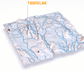 Places with similar names to Tawnglaw, Myanmar ::
Disclaimer :: Information on this page comes without warranty of any kind |
||
|
Where is Tawnglaw? Elevation and coordinates ::
Latitude (lat): 20°29'0"N Longitude (lon): 97°13'0"E
Elevation (approx.): 1007m (map arrows pan, magnifying glasses zoom) |
||
|
Visiting Tawnglaw? Hotel/Accommodation ::
Book a hotel in Tawnglaw Travel Guide ::
Buy a travel guide for Myanmar rental cars ::
car rental offers GPS waypoint ::
download a GPX waypoint (PoI) of Tawnglaw for your GPS receiver
|
||