|
search place name
|
||
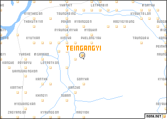
Teingangyi (Mandalay, Myanmar)Teingangyi is a town in the Mandalay region of Myanmar. An overview map of the region around Teingangyi is displayed below.
regional and 3d topo map of Teingangyi, Myanmar ::
Teingangyi airports ::
The nearest airport is MDL - Mandalay Intl, located 54.9 km north of Teingangyi.
Other airports nearby include HEH - Heho (85.8 km south east), LSH - Lashio (254.3 km north east), Nearby towns ::
Myogon (1.7km west) //
Odokkon (3.9km south west) //
Myotha (3.9km north west) //
Pwelongyaw (4.1km north east) //
Kangwe (4.1km north west) //
Thabyedaung (5.1km north west) //
Kinywa (5.1km north west) //
Gonywa (5.6km south) //
Myodwin (5.8km north) //
Tanbingon (5.5km west) //
Nyaungbinywa (6.5km north west) //
Chinthelet (6.4km north west) //
Myainggon (7.4km north) //
Kanzwe (7.6km south) //
Myingyakan (7.6km south) //
Letpatkon (7.2km west) //
Ingan (7.2km west) //
Pakan (8.2km north west) //
Thanatkhadaw (7.8km north west) //
Nyaungbintha (9.0km north east) //
Tawdwin (9.0km north east) //
Thinganzwe (8.9km south west) //
Hmaingmaw (10.1km north east) //
[all distances 'as the bird flies' and approximate] 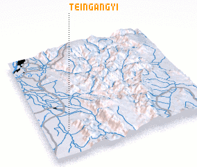 Places with similar names to Teingangyi, Myanmar ::
// Tungan Ajiya (NG)
// Hteingangyi (MM)
Disclaimer :: Information on this page comes without warranty of any kind |
||
|
Where is Teingangyi? Elevation and coordinates ::
Latitude (lat): 21°14'0"N Longitude (lon): 96°9'0"E
Elevation (approx.): 116m (map arrows pan, magnifying glasses zoom) |
||
|
Visiting Teingangyi? Hotel/Accommodation ::
Book a hotel in Teingangyi Travel Guide ::
Buy a travel guide for Myanmar rental cars ::
car rental offers GPS waypoint ::
download a GPX waypoint (PoI) of Teingangyi for your GPS receiver
|
||