|
search place name
|
||
Temyin (Myanmar)Temyin is a town in Myanmar. An overview map of the region around Temyin is displayed below.
regional and 3d topo map of Temyin, Myanmar ::

Temyin airports ::
The nearest airport is MDL - Mandalay Intl, located 161.6 km north east of Temyin.
Other airports nearby include KYP - Kyaukpyu (197.6 km south west), AKY - Sittwe (211.4 km west), Nearby towns ::
Zaungdawgan (0.0km north) //
Suboktan (1.7km west) //
Ywathit (1.9km south) //
Kabaungde (1.9km south) //
Teingan (1.7km east) //
Lungyegan (1.7km east) //
Magyizauk (2.5km north east) //
Onbwedaw (3.5km west) //
Nyaungmyitpwa (3.5km west) //
Ywathit (3.7km north) //
Uyin (3.9km north west) //
Nyizu (3.9km north west) //
Aleywa (4.1km north west) //
Ywathit (4.1km north west) //
Subangyaung (3.9km south west) //
Kyatsu (3.9km south west) //
Thitchogon (3.9km south west) //
Lingadaw (3.9km south east) //
Chaukywa (5.1km south west) //
Ywangegan (5.1km south west) //
Kanzaung (5.1km north east) //
Chaungbo West (5.1km south east) //
Konywa (5.1km south east) //
Kyeiksu (5.6km south) //
Magyigon (5.2km east) //
Mingan (5.8km south) //
Magyigan (5.8km north) //
Suyitkan (5.8km south) //
Chaungdet (5.8km north) //
[all distances 'as the bird flies' and approximate] 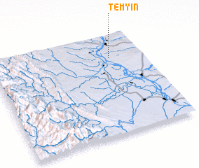 Places with similar names to Temyin, Myanmar ::
Disclaimer :: Information on this page comes without warranty of any kind |
||
|
Where is Temyin? Elevation and coordinates ::
Latitude (lat): 20°46'0"N Longitude (lon): 94°47'0"E
Elevation (approx.): 90m (map arrows pan, magnifying glasses zoom) |
||
|
Visiting Temyin? Hotel/Accommodation ::
Book a hotel in Temyin Travel Guide ::
Buy a travel guide for Myanmar rental cars ::
car rental offers GPS waypoint ::
download a GPX waypoint (PoI) of Temyin for your GPS receiver
|
||