|
search place name
|
||
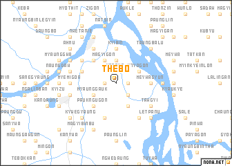
Thebo (Myanmar)Thebo is a town in Myanmar. An overview map of the region around Thebo is displayed below.
regional and 3d topo map of Thebo, Myanmar ::
Thebo airports ::
The nearest airport is MDL - Mandalay Intl, located 177.8 km north east of Thebo.
Other airports nearby include KYP - Kyaukpyu (180.6 km south west), AKY - Sittwe (201.0 km west), Nearby towns ::
Ngapyawin (1.7km west) //
Sandwin (1.9km north) //
Kanzwe (1.9km north) //
Bogon (1.7km east) //
Thapangon (2.5km north east) //
Konde (2.5km south east) //
Pyogingon (2.5km south east) //
Thigon (2.5km south east) //
Yegyipaukkon (3.7km north) //
Magyigon (4.1km north west) //
Myaunggauk (3.9km south west) //
Nyaunggon (4.1km south east) //
Thanatkon (3.9km north east) //
Mayogon (3.9km north east) //
Ywathagon (5.1km north west) //
Paukngugon (5.1km south west) //
Kyibin (5.6km north) //
Meywagyun (5.2km east) //
Shadaw (5.2km east) //
Taunggon (5.8km south) //
Tawdwin (5.5km west) //
Padibinkon (5.5km west) //
Kyethingagyun (6.6km north west) //
Thayetchin (6.4km north west) //
Tawgyi (6.4km south east) //
Talingyigon (6.6km south east) //
Myemigon (6.9km west) //
Kyaukyekyun (6.9km east) //
Padeingon (7.2km west) //
[all distances 'as the bird flies' and approximate] 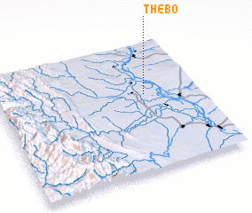 Places with similar names to Thebo, Myanmar ::
Disclaimer :: Information on this page comes without warranty of any kind |
||
|
Where is Thebo? Elevation and coordinates ::
Latitude (lat): 20°36'0"N Longitude (lon): 94°44'0"E
Elevation (approx.): 48m (map arrows pan, magnifying glasses zoom) |
||
|
Visiting Thebo? Hotel/Accommodation ::
Book a hotel in Thebo Travel Guide ::
Buy a travel guide for Myanmar rental cars ::
car rental offers GPS waypoint ::
download a GPX waypoint (PoI) of Thebo for your GPS receiver
|
||