|
search place name
|
||
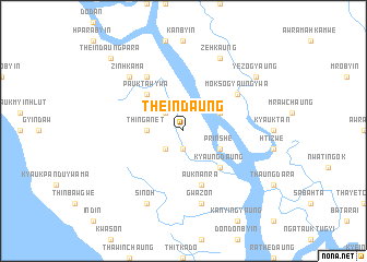
Theindaung (Rakhine, Myanmar)Theindaung is a town in the Rakhine region of Myanmar. An overview map of the region around Theindaung is displayed below.
regional and 3d topo map of Theindaung, Myanmar ::
Theindaung airports ::
The nearest airport is AKY - Sittwe, located 56.0 km south of Theindaung.
Other airports nearby include CXB - Cox's Bazar Coxs Bazar (119.3 km north west), KYP - Kyaukpyu (158.5 km south east), CGP - Chittagong Shah Amanat Intl (202.9 km north west), Nearby towns ::
Atet Kyaungdaung (1.9km south) //
Thabyedaw (2.5km north west) //
Byaingdaung (2.5km south west) //
Thinganet (3.5km west) //
Prindaw (3.9km north east) //
Prinshe (3.9km south east) //
Kyaungdaung (5.1km south east) //
Pauktawywa (5.1km north west) //
Auk Nanra (5.8km south) //
Moksogyaungywa (6.4km north east) //
Okthema (6.6km north west) //
Gwazon (7.6km south) //
Zinhkama (7.6km north west) //
Zehkaung (8.2km north east) //
Sinoh (8.2km south west) //
Yezogyaung (8.9km north east) //
Theindaungpāra (10.2km north west) //
[all distances 'as the bird flies' and approximate] 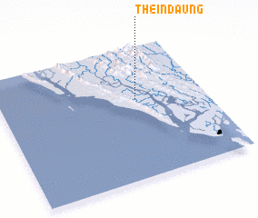 Places with similar names to Theindaung, Myanmar ::
// Thanat-aing (MM)
// Thandaung (MM)
// Thandaung (MM)
// Thandaung (MM)
// Thandaung (MM)
// Thandaung (MM)
// Thindaung (MM)
// Thondaung (MM)
// Thondaung (MM)
// Thạnh Danh (2) (VN)
Disclaimer :: Information on this page comes without warranty of any kind |
||
|
Where is Theindaung? Elevation and coordinates ::
Latitude (lat): 20°36'0"N Longitude (lon): 92°40'0"E
Elevation (approx.): 2m (map arrows pan, magnifying glasses zoom) |
||
|
Visiting Theindaung? Hotel/Accommodation ::
Book a hotel in Theindaung Travel Guide ::
Buy a travel guide for Myanmar rental cars ::
car rental offers GPS waypoint ::
download a GPX waypoint (PoI) of Theindaung for your GPS receiver
|
||