|
search place name
|
||
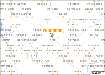
Thibingon (Mandalay, Myanmar)Thibingon is a town in the Mandalay region of Myanmar. An overview map of the region around Thibingon is displayed below.
regional and 3d topo map of Thibingon, Myanmar ::
Thibingon airports ::
The nearest airport is MDL - Mandalay Intl, located 70.5 km north east of Thibingon.
Other airports nearby include HEH - Heho (134.7 km east), Nearby towns ::
Thangon (0.0km north) //
Paukkan (1.9km south) //
Yega (1.9km south) //
Magyigon (1.7km east) //
Yonzingyi (1.9km north) //
Thabutkon (4.1km south west) //
Namozin (3.9km north east) //
Yedwet (5.6km south) //
Chaungwin (5.2km west) //
Hnawdaw (5.5km east) //
Tandaw (5.8km south) //
Thanbo (5.8km north) //
Letpanzauk (5.8km south) //
Pabaung (5.5km west) //
Aingmayo (6.4km south east) //
Nabugyin (6.4km south west) //
Kaywa (6.9km east) //
Nyangan (6.9km east) //
Kokkogyin (7.2km west) //
Yeni (7.6km south) //
Thayetkan (7.2km east) //
Thandan (7.6km north) //
Ywadanshe (7.2km east) //
Thabyebin (7.2km east) //
Nyinyaung (7.2km east) //
Tanaunggaing (7.6km north east) //
Tanaunggyin (7.6km south east) //
Kaingzauk (7.6km south west) //
Shawbyugon (8.2km south east) //
[all distances 'as the bird flies' and approximate] 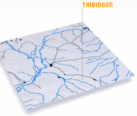
Disclaimer :: Information on this page comes without warranty of any kind |
||
|
Where is Thibingon? Elevation and coordinates ::
Latitude (lat): 21°11'0"N Longitude (lon): 95°35'0"E
Elevation (approx.): 267m (map arrows pan, magnifying glasses zoom) |
||
|
Visiting Thibingon? Hotel/Accommodation ::
Book a hotel in Thibingon Travel Guide ::
Buy a travel guide for Myanmar rental cars ::
car rental offers GPS waypoint ::
download a GPX waypoint (PoI) of Thibingon for your GPS receiver
|
||