|
search place name
|
||
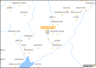
Tongkat (Kachin State, Myanmar)Tongkat is a town in the Kachin State region of Myanmar. An overview map of the region around Tongkat is displayed below.
regional and 3d topo map of Tongkat, Myanmar ::
Tongkat airports ::
The nearest airport is MYT - Myitkyina, located 92.6 km east of Tongkat.
Other airports nearby include PBU - Putao (242.4 km north east), Nearby towns ::
Mapyin (1.9km south) //
Sabyigahtawng (1.7km east) //
U Krugahtawng (3.4km east) //
Lawsun (4.1km south east) //
'Nbugahtawng (4.1km north east) //
Loipaw (5.0km south east) //
Aletu (5.0km south east) //
Mankin (5.0km south east) //
Majai (5.0km north east) //
Wasangpang (5.0km north east) //
Khanti (5.8km north) //
Panla (5.8km south) //
Hwehpasi (6.5km south west) //
Chaungwa (6.5km south east) //
Kawabum (7.0km west) //
Karengahtawng (9.0km north east) //
Hpatawng (10.0km south west) //
[all distances 'as the bird flies' and approximate]  Places with similar names to Tongkat, Myanmar ::
// Dinagkita (PH)
// Dongo-Kete (CD)
// Dongkait (ID)
// Tunggakiat (ID)
// Dungkit (MY)
// Dangkado (NG)
// Dong Cot (VN)
// Ðông Kết (VN)
// Ðồng Kiệt (VN)
// Ðông Quất (VN)
Disclaimer :: Information on this page comes without warranty of any kind |
||
|
Where is Tongkat? Elevation and coordinates ::
Latitude (lat): 25°20'0"N Longitude (lon): 96°26'0"E
Elevation (approx.): 179m (map arrows pan, magnifying glasses zoom) |
||
|
Visiting Tongkat? Hotel/Accommodation ::
Book a hotel in Tongkat Travel Guide ::
Buy a travel guide for Myanmar rental cars ::
car rental offers GPS waypoint ::
download a GPX waypoint (PoI) of Tongkat for your GPS receiver
|
||