|
search place name
|
||
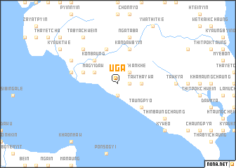
Uga (Rakhine, Myanmar)Uga is a town in the Rakhine region of Myanmar. An overview map of the region around Uga is displayed below.
regional and 3d topo map of Uga, Myanmar ::
Uga airports ::
The nearest airport is KYP - Kyaukpyu, located 58.0 km north west of Uga.
Other airports nearby include SNW - Thandwe (76.9 km south east), AKY - Sittwe (161.7 km north west), Nearby towns ::
Kôkkabyin (1.8km east) //
Zikha (1.9km south) //
Kyaukthankhe (2.6km north east) //
Tawtha-ywa (3.5km east) //
Yezu (4.0km north west) //
Magyidaw (4.0km north west) //
Kônbaung (5.1km north west) //
Asheye (5.1km north west) //
Taungpyo (5.1km south east) //
Anauk-ywa (5.6km west) //
Aunghlabyin (5.6km west) //
Gangawbyin (5.8km north) //
Kandawbyin (5.8km north) //
Ngataba (7.6km north) //
Kyauknaga (7.3km west) //
Seiknabyin (7.3km west) //
Wanetchwein (7.7km north west) //
Theinhtauk (7.9km north west) //
Tabyachwein (9.1km north west) //
Thinbaungchaung (8.9km south east) //
Kywe-o (10.2km south east) //
[all distances 'as the bird flies' and approximate] 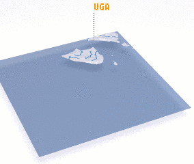 Places with similar names to Uga, Myanmar ::
Disclaimer :: Information on this page comes without warranty of any kind |
||
|
Where is Uga? Elevation and coordinates ::
Latitude (lat): 18°58'0"N Longitude (lon): 93°48'0"E
Elevation (approx.): 10m (map arrows pan, magnifying glasses zoom) |
||
|
Visiting Uga? Hotel/Accommodation ::
Book a hotel in Uga Travel Guide ::
Buy a travel guide for Myanmar rental cars ::
car rental offers GPS waypoint ::
download a GPX waypoint (PoI) of Uga for your GPS receiver
|
||