|
search place name
|
||
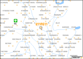
Uyingyi (Mandalay, Myanmar)Uyingyi is a town in the Mandalay region of Myanmar. An overview map of the region around Uyingyi is displayed below.
regional and 3d topo map of Uyingyi, Myanmar ::
Uyingyi airports ::
The nearest airport is MDL - Mandalay Intl, located 11.6 km west of Uyingyi.
Other airports nearby include HEH - Heho (125.6 km south east), LSH - Lashio (225.0 km north east), Nearby towns ::
Thindaungywashe (0.0km north) //
Taung Hin-ngu (1.7km west) //
Kyetsha (1.7km west) //
Nga-o (1.9km south) //
Ywatha (2.5km north west) //
Hin-ngu (2.5km north west) //
Myauk Hin-ngu (2.5km north west) //
Kyethmya (2.5km north east) //
Nyaungbinzauk (2.5km south west) //
Nyaungwun (3.7km south) //
Kyetsein (4.1km north east) //
Tawma (3.9km north east) //
Letpan (3.9km south east) //
Swezon (5.1km north west) //
Palambo (5.1km north west) //
Chaungzon (5.1km north west) //
Pingya (5.1km north east) //
Konni (5.6km north) //
Pahtodaing (5.6km south) //
Thinbok (5.6km south) //
Nanni (5.2km west) //
Padaungga (5.8km south) //
Mezebin (5.8km south) //
Shanywa (5.5km west) //
Wayindok (5.8km north) //
Onletkauk (5.5km west) //
Magyidan (6.5km south east) //
Thindaung (6.4km south east) //
Kyaungbangon (6.4km south west) //
[all distances 'as the bird flies' and approximate] 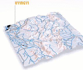 Places with similar names to Uyingyi, Myanmar ::
Disclaimer :: Information on this page comes without warranty of any kind |
||
|
Where is Uyingyi? Elevation and coordinates ::
Latitude (lat): 21°40'0"N Longitude (lon): 96°5'0"E
Elevation (approx.): 85m (map arrows pan, magnifying glasses zoom) |
||
|
Visiting Uyingyi? Hotel/Accommodation ::
Book a hotel in Uyingyi Travel Guide ::
Buy a travel guide for Myanmar rental cars ::
car rental offers GPS waypoint ::
download a GPX waypoint (PoI) of Uyingyi for your GPS receiver
|
||