|
search place name
|
||
Wadi (Myanmar)Wadi is a town in Myanmar. An overview map of the region around Wadi is displayed below.
regional and 3d topo map of Wadi, Myanmar ::

Wadi airports ::
The nearest airport is HEH - Heho, located 210.9 km north of Wadi.
Other airports nearby include RGN - Yangon Intl (219.7 km south), Nearby towns ::
Tegyikin (1.9km south) //
Thagaya (1.9km south) //
Milaunggon (1.8km west) //
Wetpyugon (2.6km north west) //
Kalazu (2.6km south west) //
Chaungywa (3.5km east) //
Yegyaw (3.5km east) //
Pebok (3.5km east) //
Kyizo (3.7km north) //
Thugaungbyit (3.7km south) //
Taungwingon (3.5km west) //
Thayettaw (4.1km north east) //
Myogyi (4.1km north west) //
Yebyukhin (4.1km north west) //
Kabaung (4.1km north west) //
Tantabin (4.1km south east) //
Pebingon (4.0km north west) //
Shanywa (4.1km south west) //
Zibyugaing Ashe (4.1km south west) //
Momakha (4.1km south west) //
Dothaung (5.1km north east) //
Seikkyi (5.1km south east) //
Onbin (5.1km south west) //
Inyagyi (5.6km south) //
Paunglaungdin (5.6km north) //
Uyindaw (5.3km west) //
Thaungdainggon (5.6km west) //
Shwekyaunggon (5.6km west) //
Putsu (5.8km north) //
[all distances 'as the bird flies' and approximate] 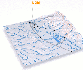 Places with similar names to Wadi, Myanmar ::
Disclaimer :: Information on this page comes without warranty of any kind |
||
|
Where is Wadi? Elevation and coordinates ::
Latitude (lat): 18°52'0"N Longitude (lon): 96°28'0"E
Elevation (approx.): 40m (map arrows pan, magnifying glasses zoom) |
||
|
Visiting Wadi? Hotel/Accommodation ::
Book a hotel in Wadi Travel Guide ::
Buy a travel guide for Myanmar rental cars ::
car rental offers GPS waypoint ::
download a GPX waypoint (PoI) of Wadi for your GPS receiver
|
||