|
search place name
|
||
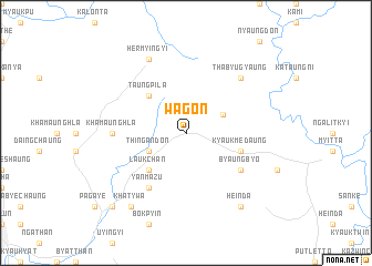
Wagon (Myanmar)Wagon is a town in Myanmar. An overview map of the region around Wagon is displayed below.
regional and 3d topo map of Wagon, Myanmar ::
Wagon airports ::
The nearest airport is MGZ - Myeik, located 194.6 km south of Wagon.
Other airports nearby include HHQ - Prachuap Khiri Khan Hua Hin (241.1 km south east), Nearby towns ::
Thingandon (4.0km south west) //
Pyinthadaw (4.0km north east) //
Laukchan (5.2km south west) //
Taungpila (5.2km north west) //
Kyaukmedaung (5.7km east) //
Byaungbyo (6.5km south east) //
Yanmazu (6.6km south west) //
Khamaunghla (7.2km west) //
Thabyugyaung (7.7km north east) //
Hermyingyi (8.2km north west) //
Khat-ywa (9.2km south west) //
Heinda (9.2km south east) //
Wutthe (10.3km south west) //
[all distances 'as the bird flies' and approximate] 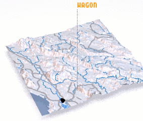 Places with similar names to Wagon, Myanmar ::
Disclaimer :: Information on this page comes without warranty of any kind |
||
|
Where is Wagon? Elevation and coordinates ::
Latitude (lat): 14°11'0"N Longitude (lon): 98°23'0"E
Elevation (approx.): 195m (map arrows pan, magnifying glasses zoom) |
||
|
Visiting Wagon? Hotel/Accommodation ::
Book a hotel in Wagon Travel Guide ::
Buy a travel guide for Myanmar rental cars ::
car rental offers GPS waypoint ::
download a GPX waypoint (PoI) of Wagon for your GPS receiver
|
||