|
search place name
|
||
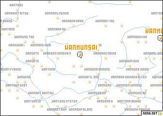
Wān Münsai (Shan, Myanmar)Wān Münsai is a town in the Shan region of Myanmar. An overview map of the region around Wān Münsai is displayed below.
regional and 3d topo map of Wān Münsai, Myanmar ::
Wān Münsai airports ::
The nearest airport is KET - Kengtung, located 83.0 km south east of Wān Münsai.
Other airports nearby include MOG - Mong Hsat (158.7 km south), THL - Tachilek Tachileik (177.9 km south east), LSH - Lashio (190.2 km north west), Nearby towns ::
Wān Pa-hka (1.9km south) //
Wān Mawngtaü (1.9km north) //
Wān Pu-hsensa-hka (2.5km south west) //
Wān Hwè-tam (2.5km south west) //
Wān Nammawngnö (2.5km north east) //
Wān Hsenhta-pi (3.9km north east) //
Wān Ho-nammawng (5.1km south east) //
Wān Hsenmöngpan (5.2km west) //
Wān Pawknoi-nö (5.2km east) //
Wān Münsan (5.8km south) //
Wān Sa-ti-lōng (5.8km south) //
Mān Honampak (7.6km north) //
Wān Nampāk (7.6km north west) //
Wān Ho-namhsaw (7.6km south east) //
Wān Tè-pa (7.8km south west) //
Wān Namting (9.0km north east) //
Wān Kè-pü (9.0km south east) //
[all distances 'as the bird flies' and approximate]  Places with similar names to Wān Münsai, Myanmar ::
// Wān Münsai (MM)
// Wān Mansaw (MM)
// Wān Mün-a-hsa (MM)
// Wān Mün-a-hsa (MM)
// Wān Münhsai (MM)
// Wān Münsai (MM)
// Wān Münsai (MM)
// Wān Münsai (MM)
Disclaimer :: Information on this page comes without warranty of any kind |
||
|
Where is Wān Münsai? Elevation and coordinates ::
Latitude (lat): 21°57'0"N Longitude (lon): 99°14'0"E
Elevation (approx.): 1229m (map arrows pan, magnifying glasses zoom) |
||
|
Visiting Wān Münsai? Hotel/Accommodation ::
Book a hotel in Wān Münsai Travel Guide ::
Buy a travel guide for Myanmar rental cars ::
car rental offers GPS waypoint ::
download a GPX waypoint (PoI) of Wān Münsai for your GPS receiver
|
||