|
search place name
|
||
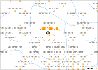
Wān Namya (Shan, Myanmar)Wān Namya is a town in the Shan region of Myanmar. An overview map of the region around Wān Namya is displayed below.
regional and 3d topo map of Wān Namya, Myanmar ::
Wān Namya airports ::
The nearest airport is KET - Kengtung, located 17.9 km south east of Wān Namya.
Other airports nearby include MOG - Mong Hsat (108.2 km south), THL - Tachilek Tachileik (113.6 km south), LSH - Lashio (252.2 km north west), Nearby towns ::
Wān Hsenhkamwang (0.0km north) //
Wān Namsu (1.7km east) //
Wān Tonglik (1.9km south) //
Wān Pangping (2.5km south east) //
Wān Ko (2.5km south west) //
Wān Ho-namsu (3.7km north) //
Wān Namkat (3.9km north east) //
Wān Long (3.9km south west) //
Wān Nawnglōm (5.1km south east) //
Wān Pang (5.1km south west) //
Wān Nam (5.6km south) //
Wān Htün (5.6km south) //
Wān Hkung (5.6km south) //
Wān Lai (5.6km south) //
Wān Ho-yang (5.6km south) //
Wān Yang (5.8km south) //
Wān Yanghsaw (5.8km south) //
Wān Ka (5.8km south) //
Wān Panghok (6.4km south west) //
Wān Kawng (6.5km south east) //
Wān Yanghsaw (6.5km south east) //
Wān Ho-htat (6.5km south west) //
Wān Na-ping (6.9km east) //
Wān Hkam (6.9km east) //
Wān Hsawng (6.9km east) //
Wān Hè (7.4km south) //
Wān Wathsao (7.4km south) //
Wān Ho-na (7.4km south) //
Nawngkang (7.1km east) //
[all distances 'as the bird flies' and approximate] 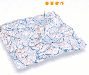 Places with similar names to Wān Namya, Myanmar ::
// Wān Mye (MM)
// Wān Nam Yü (MM)
Disclaimer :: Information on this page comes without warranty of any kind |
||
|
Where is Wān Namya? Elevation and coordinates ::
Latitude (lat): 21°27'0"N Longitude (lon): 99°34'0"E
Elevation (approx.): 1177m (map arrows pan, magnifying glasses zoom) |
||
|
Visiting Wān Namya? Hotel/Accommodation ::
Book a hotel in Wān Namya Travel Guide ::
Buy a travel guide for Myanmar rental cars ::
car rental offers GPS waypoint ::
download a GPX waypoint (PoI) of Wān Namya for your GPS receiver
|
||