|
search place name
|
||
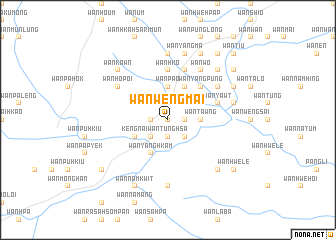
Wān Wēngmai (Shan, Myanmar)Wān Wēngmai is a town in the Shan region of Myanmar. An overview map of the region around Wān Wēngmai is displayed below.
regional and 3d topo map of Wān Wēngmai, Myanmar ::
Wān Wēngmai airports ::
The nearest airport is KET - Kengtung, located 76.9 km west of Wān Wēngmai.
Other airports nearby include THL - Tachilek Tachileik (82.3 km south west), MOG - Mong Hsat (131.8 km south west), LPQ - Luang Prabang Luang Phabang Intl (232.1 km south east), Nearby towns ::
Wān Möng-hkawng (0.0km north) //
Wān Pā-hsak (0.0km north) //
Wān Ta-pao (1.9km north) //
Wān Möng Hüm (1.9km north) //
Wān Hawngkwē-long (1.9km north) //
Wān Lemfai (1.7km west) //
Wān Hsalimum (1.7km west) //
Wān Tūnghsa (1.9km south) //
Wān Ta-höng (1.9km south) //
Wān Sampā (1.7km east) //
Wān Htāngsang (2.5km north east) //
Wān Ho-lōng (2.5km south west) //
Wān Möng Lai (2.5km south west) //
Wān Kawhkoi (2.5km south east) //
Wān Bē (2.5km south east) //
Wān Lawngwō (2.5km south east) //
Wān Poi (2.5km south east) //
Wān Pao (3.7km north) //
Wān Palao (3.7km north) //
Wān Tawng (3.5km east) //
Wān Nawnglāng (3.9km north east) //
Kēng Nai (3.9km south west) //
Wān Pā-man (4.1km north east) //
Wān Hawngsang (4.1km north east) //
Wān Yanghkam (4.1km south west) //
Wān Sāngtawng (5.1km north east) //
Wān Yāngpūng (5.1km north east) //
Wān Hko (5.6km north) //
Wān Kawm (5.5km east) //
[all distances 'as the bird flies' and approximate]  Places with similar names to Wān Wēngmai, Myanmar :: Disclaimer :: Information on this page comes without warranty of any kind |
||
|
Where is Wān Wēngmai? Elevation and coordinates ::
Latitude (lat): 21°7'0"N Longitude (lon): 100°21'0"E
Elevation (approx.): 550m (map arrows pan, magnifying glasses zoom) |
||
|
Visiting Wān Wēngmai? Hotel/Accommodation ::
Book a hotel in Wān Wēngmai Travel Guide ::
Buy a travel guide for Myanmar rental cars ::
car rental offers GPS waypoint ::
download a GPX waypoint (PoI) of Wān Wēngmai for your GPS receiver
|
||