|
search place name
|
||
Yang Hkam (Shan, Myanmar)Yang Hkam is a town in the Shan region of Myanmar. An overview map of the region around Yang Hkam is displayed below.
regional and 3d topo map of Yang Hkam, Myanmar ::

Yang Hkam airports ::
The nearest airport is KET - Kengtung, located 60.9 km east of Yang Hkam.
Other airports nearby include MOG - Mong Hsat (85.8 km south), THL - Tachilek Tachileik (126.5 km south east), LSH - Lashio (232.0 km north west), Nearby towns ::
Wān Pōng (0.0km north) //
Wān Na-taw (0.0km north) //
Wān Hangna-hsa (1.9km north) //
Wān Monkat (1.9km north) //
Wān Hsi-lik (1.9km south) //
Wān Hpa-htūn (1.7km west) //
Wān Nahkaw (3.7km north) //
Wān Na-yang (3.7km south) //
Wān Hku (3.7km south) //
Wān Hsak (4.1km south east) //
Wān Na-pōng (4.1km south east) //
Wān Na (4.1km south east) //
Wān Mak-ka (5.8km south) //
Wān Hi-lü (5.8km south) //
Wān Hwi-hsūm (5.8km south) //
Wān Pōng (5.8km south) //
Wān Sawmsüng (5.8km south) //
Wān Nao (5.8km north) //
Wān Hōhko (5.8km north) //
Wān Waw (5.8km north) //
Wān Hüntao (5.8km north) //
Wān Mye (6.4km south west) //
Wān Kat (7.6km north) //
Wān Hēnnao (7.6km north) //
Wān Hwai-tēng (7.6km south) //
Wān Loi (7.6km south) //
Wān Pyek (7.6km south) //
Wān Pawlong (7.8km north east) //
Möng Pu-awn (8.2km south east) //
[all distances 'as the bird flies' and approximate] 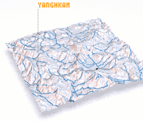
Disclaimer :: Information on this page comes without warranty of any kind |
||
|
Where is Yang Hkam? Elevation and coordinates ::
Latitude (lat): 21°16'0"N Longitude (lon): 99°3'0"E
Elevation (approx.): 586m (map arrows pan, magnifying glasses zoom) |
||
|
Visiting Yang Hkam? Hotel/Accommodation ::
Book a hotel in Yang Hkam Travel Guide ::
Buy a travel guide for Myanmar rental cars ::
car rental offers GPS waypoint ::
download a GPX waypoint (PoI) of Yang Hkam for your GPS receiver
|
||