|
search place name
|
||
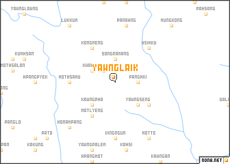
Yawnglaik (Shan, Myanmar)Yawnglaik is a town in the Shan region of Myanmar. An overview map of the region around Yawnglaik is displayed below.
regional and 3d topo map of Yawnglaik, Myanmar ::
Yawnglaik airports ::
The nearest airport is LSH - Lashio, located 158.5 km west of Yawnglaik.
Other airports nearby include KET - Kengtung (159.5 km south), Nearby towns ::
Aikyeng (2.5km north west) //
Pānghki (3.4km east) //
Songramang (3.7km north) //
Kwan Hso (3.9km north west) //
Yawngseng (5.0km south east) //
Kawngpha (5.0km south west) //
Yawnghsung (6.3km south east) //
Mānkon (6.5km north west) //
Motlyeng (6.5km south west) //
Kongmeng (6.5km north west) //
Mothsamu (6.8km west) //
Hsihku (7.6km north east) //
Honampang (10.1km south west) //
[all distances 'as the bird flies' and approximate] 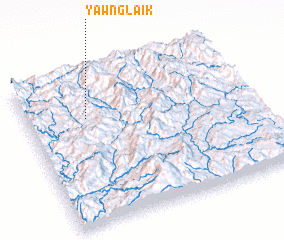 Places with similar names to Yawnglaik, Myanmar ::
// Yoncalık (TR)
// Yoncalık (TR)
// Yoncalık (TR)
// Yoncalık (TR)
// Yongalık (TR)
// Yankee Lake (US)
// Yangoulika (CF)
// Yanga-Leka (CD)
// Yankee Lake (US)
// Yawnglaik (MM)
Disclaimer :: Information on this page comes without warranty of any kind |
||
|
Where is Yawnglaik? Elevation and coordinates ::
Latitude (lat): 22°42'0"N Longitude (lon): 99°16'0"E
Elevation (approx.): 1514m (map arrows pan, magnifying glasses zoom) |
||
|
Visiting Yawnglaik? Hotel/Accommodation ::
Book a hotel in Yawnglaik Travel Guide ::
Buy a travel guide for Myanmar rental cars ::
car rental offers GPS waypoint ::
download a GPX waypoint (PoI) of Yawnglaik for your GPS receiver
|
||