|
search place name
|
||
Yegyi (Myanmar)Yegyi is a town in Myanmar. An overview map of the region around Yegyi is displayed below.
regional and 3d topo map of Yegyi, Myanmar ::

Yegyi airports ::
The nearest airport is RGN - Yangon Intl, located 159.0 km south west of Yegyi.
Nearby towns ::
Daiktu (0.0km north) //
Sabyagyi (0.0km north) //
Kywèthalin (1.9km north) //
Mamayan Atet (1.8km west) //
Omyedu (1.8km east) //
Pattalaywa (2.6km north east) //
Mamayan Ale (2.6km south west) //
Mattawgôn (3.7km north) //
Pattala-thit (4.0km north east) //
Kyathe Atet (4.0km north west) //
Teikpauk (4.0km south east) //
Kya-in (4.1km north east) //
Wetlataw (4.1km south east) //
Lèwainggyi (5.1km north west) //
Dalawbama (5.1km south east) //
Gyogon (5.6km north) //
Nyaungdan (5.6km north) //
Kywegyo-in (5.6km north) //
Dagala-karenzu (5.6km east) //
Naunggon (6.6km north west) //
Hlelangu (6.6km north east) //
Mabi-atetsu (6.6km south east) //
Pēthaung (6.6km south west) //
Mabi-ywama (6.6km south east) //
Pawdawmu (6.5km south east) //
Nyaunggon (7.4km north) //
Ngabyetin (7.4km north) //
Shwethaung (7.4km south) //
Innet-auk (7.6km north) //
[all distances 'as the bird flies' and approximate] 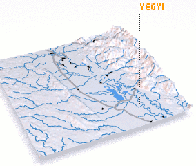 Places with similar names to Yegyi, Myanmar ::
Disclaimer :: Information on this page comes without warranty of any kind |
||
|
Where is Yegyi? Elevation and coordinates ::
Latitude (lat): 18°13'0"N Longitude (lon): 96°45'0"E
Elevation (approx.): 20m (map arrows pan, magnifying glasses zoom) |
||
|
Visiting Yegyi? Hotel/Accommodation ::
Book a hotel in Yegyi Travel Guide ::
Buy a travel guide for Myanmar rental cars ::
car rental offers GPS waypoint ::
download a GPX waypoint (PoI) of Yegyi for your GPS receiver
|
||