|
search place name
|
||
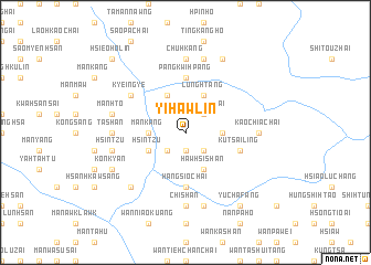
Yi-hawlin (Shan, Myanmar)Yi-hawlin is a town in the Shan region of Myanmar. An overview map of the region around Yi-hawlin is displayed below.
regional and 3d topo map of Yi-hawlin, Myanmar ::
Yi-hawlin airports ::
The nearest airport is LSH - Lashio, located 130.7 km south west of Yi-hawlin.
Other airports nearby include MYT - Myitkyina (215.2 km north west), Nearby towns ::
Pangchong (1.9km south) //
Hsieokai-hi (2.5km south west) //
Happu-lawng Chai (2.5km south west) //
Sintzu (2.5km south east) //
Kaochia Chai (2.5km north east) //
Mān Kang (3.4km west) //
Wonghsi Chai (3.4km east) //
Hsintzu (3.9km south west) //
Hawhsishan (4.1km south east) //
Hsieo-htang (4.1km north west) //
Lunghtang (4.1km north east) //
Pangkwi-hpang (5.6km north) //
Mān Law (5.6km south) //
Hangsio Chai (5.6km south) //
Kutsailing (5.4km east) //
Muchang (5.4km east) //
Kyeingye (6.3km north west) //
Chishan (7.4km south) //
Ta-shan (6.8km west) //
Chufun Chai (6.8km west) //
Mān Hin (7.4km north) //
Kaochia Chai (6.8km east) //
Chuhkang (7.4km north) //
Hsintzu (7.0km west) //
Mān Law (7.6km south) //
Mān Hto (7.0km west) //
Shuikaw Chai (7.6km north) //
Namto (7.5km south west) //
Hpawa-htang (7.7km south west) //
[all distances 'as the bird flies' and approximate]  Places with similar names to Yi-hawlin, Myanmar :: Disclaimer :: Information on this page comes without warranty of any kind |
||
|
Where is Yi-hawlin? Elevation and coordinates ::
Latitude (lat): 23°50'0"N Longitude (lon): 98°38'0"E
Elevation (approx.): 972m (map arrows pan, magnifying glasses zoom) |
||
|
Visiting Yi-hawlin? Hotel/Accommodation ::
Book a hotel in Yi-hawlin Travel Guide ::
Buy a travel guide for Myanmar rental cars ::
car rental offers GPS waypoint ::
download a GPX waypoint (PoI) of Yi-hawlin for your GPS receiver
|
||