|
search place name
|
||
Yonthalin (Ayeyarwady, Myanmar)Yonthalin is a town in the Ayeyarwady region of Myanmar. An overview map of the region around Yonthalin is displayed below.
regional and 3d topo map of Yonthalin, Myanmar ::

Yonthalin airports ::
The nearest airport is RGN - Yangon Intl, located 112.5 km south east of Yonthalin.
Other airports nearby include SNW - Thandwe (147.5 km north west), KYP - Kyaukpyu (280.5 km north west), Nearby towns ::
Talokkon (1.9km south) //
Pyindaunggwin (2.6km south east) //
Thayetkon (2.6km north east) //
Leiktu (3.5km west) //
Madaw (3.7km south) //
Ingyi (3.7km north) //
Zigon (5.1km south west) //
Leikkon (5.1km north west) //
Mezalidaw (5.6km east) //
Kamauksu (5.6km west) //
Thayet-aing (5.6km east) //
Lahagyi (5.6km west) //
Migyaung-u (5.8km south) //
Yogyi (5.6km east) //
Aingzauk (5.8km south) //
Inwin (5.8km north) //
Dokyaik (5.8km north) //
Kya-in (6.5km north west) //
Zigon (6.5km north east) //
Thebyu (7.4km south) //
Neikban (7.1km east) //
Kyagyaung (7.6km south) //
Daga (7.6km north) //
Yogyi (7.7km north west) //
Zokkani (7.7km north east) //
Pauktangale (8.0km south east) //
Zidawgon (8.0km south east) //
Uyingon (8.2km north west) //
Thayetchaung (9.1km south west) //
[all distances 'as the bird flies' and approximate] 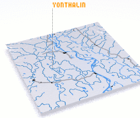 Places with similar names to Yonthalin, Myanmar :: Disclaimer :: Information on this page comes without warranty of any kind |
||
|
Where is Yonthalin? Elevation and coordinates ::
Latitude (lat): 17°32'0"N Longitude (lon): 95°18'0"E
Elevation (approx.): 14m (map arrows pan, magnifying glasses zoom) |
||
|
Visiting Yonthalin? Hotel/Accommodation ::
Book a hotel in Yonthalin Travel Guide ::
Buy a travel guide for Myanmar rental cars ::
car rental offers GPS waypoint ::
download a GPX waypoint (PoI) of Yonthalin for your GPS receiver
|
||