|
search place name
|
||
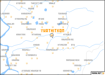
Ywathitkon (Kayin, Myanmar)Ywathitkon is a town in the Kayin region of Myanmar. An overview map of the region around Ywathitkon is displayed below.
regional and 3d topo map of Ywathitkon, Myanmar ::
Ywathitkon airports ::
The nearest airport is LPT - Lampang, located 225.6 km north east of Ywathitkon.
Nearby towns ::
Kawpalan (1.9km north) //
Naungtapan (2.6km south west) //
Myapadaing (3.7km south) //
Da-weda (3.7km north) //
Naungmi (4.1km south east) //
Htipozan (5.1km south east) //
Kawnyaing (5.1km north east) //
Nabu (5.1km north west) //
Htigale (5.3km east) //
Naung-ikhet (5.6km south) //
Naungsauk (5.3km west) //
Htiwashu (5.3km west) //
Naungkaing (5.6km east) //
Thagya (5.6km east) //
Htiswan (5.8km north) //
Methpale (6.5km south east) //
Nansale (6.6km north east) //
Inshe (6.6km north west) //
Kho-wa (6.5km south west) //
Naunghin (7.3km west) //
Nabu Tagundaing (7.7km north east) //
To-kawko (8.2km north east) //
Nopobi (8.2km north east) //
Ayu (8.0km south east) //
Hnaingkharaung (9.1km south west) //
Naungtama (10.3km north west) //
Kyonbaing (10.3km south west) //
[all distances 'as the bird flies' and approximate] 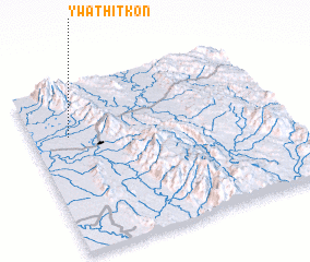 Places with similar names to Ywathitkon, Myanmar ::
// Ywathitkon (MM)
// Wathitkon (MM)
// Ywathetkôn (MM)
// Ywathitkon (MM)
// Ywathitkon (MM)
// Ywathitkon (MM)
// Ywathitkon (MM)
// Ywathitkon (MM)
// Ywathitkon (MM)
// Ywathitkon (MM)
Disclaimer :: Information on this page comes without warranty of any kind |
||
|
Where is Ywathitkon? Elevation and coordinates ::
Latitude (lat): 16°42'0"N Longitude (lon): 98°9'0"E
Elevation (approx.): 10m (map arrows pan, magnifying glasses zoom) |
||
|
Visiting Ywathitkon? Hotel/Accommodation ::
Book a hotel in Ywathitkon Travel Guide ::
Buy a travel guide for Myanmar rental cars ::
car rental offers GPS waypoint ::
download a GPX waypoint (PoI) of Ywathitkon for your GPS receiver
|
||