|
search place name
|
||
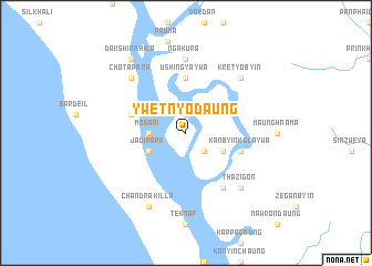
Ywetnyodaung (Rakhine, Myanmar)Ywetnyodaung is a town in the Rakhine region of Myanmar. An overview map of the region around Ywetnyodaung is displayed below.
regional and 3d topo map of Ywetnyodaung, Myanmar ::
Ywetnyodaung airports ::
The nearest airport is CXB - Cox's Bazar Coxs Bazar, located 65.6 km north west of Ywetnyodaung.
Other airports nearby include AKY - Sittwe (108.4 km south east), CGP - Chittagong Shah Amanat Intl (152.5 km north), KYP - Kyaukpyu (212.4 km south east), Nearby towns ::
Yedwingyun (1.9km north) //
Mingala (2.5km south east) //
Mosani (3.5km west) //
Dhumdumia (3.9km south west) //
Jādipāra (3.9km south west) //
Thu-ula Kalaywa (3.9km south east) //
Ale Kalaywa (3.9km south east) //
Ushingyaywa (5.6km north) //
Kalaywa (5.5km east) //
Kanbyin Kalaywa (5.5km east) //
Ledhāpāra (5.5km west) //
Atikhālipara (5.5km west) //
Mingalagyi (6.5km south east) //
Ngakura (7.4km north) //
Thazigon (7.6km south east) //
Ngangyaung (7.6km north east) //
Kretyobyin (7.6km north east) //
Chotāpāra (7.6km north west) //
Chandrakilla (8.2km south west) //
Dakshin Nhila (9.1km north west) //
[all distances 'as the bird flies' and approximate] 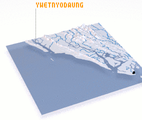 Places with similar names to Ywetnyodaung, Myanmar :: Disclaimer :: Information on this page comes without warranty of any kind |
||
|
Where is Ywetnyodaung? Elevation and coordinates ::
Latitude (lat): 20°57'0"N Longitude (lon): 92°18'0"E
Elevation (approx.): 4m (map arrows pan, magnifying glasses zoom) |
||
|
Visiting Ywetnyodaung? Hotel/Accommodation ::
Book a hotel in Ywetnyodaung Travel Guide ::
Buy a travel guide for Myanmar rental cars ::
car rental offers GPS waypoint ::
download a GPX waypoint (PoI) of Ywetnyodaung for your GPS receiver
|
||