|
search place name
|
||
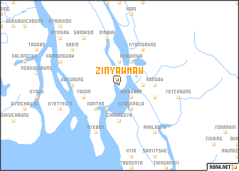
Zinyawmaw (Rakhine, Myanmar)Zinyawmaw is a town in the Rakhine region of Myanmar. An overview map of the region around Zinyawmaw is displayed below.
regional and 3d topo map of Zinyawmaw, Myanmar ::
Zinyawmaw airports ::
The nearest airport is AKY - Sittwe, located 55.2 km west of Zinyawmaw.
Other airports nearby include KYP - Kyaukpyu (77.7 km south), SNW - Thandwe (206.3 km south east), CXB - Cox's Bazar Coxs Bazar (210.3 km north west), Nearby towns ::
Daingbôn (2.5km south east) //
Taungmaw (3.5km east) //
Tenanbyin (3.7km north) //
Kyauknwa (4.1km north east) //
Kyaukpala (4.1km south east) //
Natthetke (4.1km south west) //
Kantha (5.1km south west) //
Kangaw (5.2km east) //
Chaunggya (5.6km south) //
Ngasinbôn (5.5km east) //
Tagôn (5.5km west) //
Kyaindawng (6.6km north east) //
Gyethinka (6.6km north east) //
Wetgaung (7.0km west) //
Rimbwe (7.6km north) //
Myebon (8.2km south west) //
Sarakdo (9.1km north west) //
Phalagya (9.1km south east) //
Sa-ein (8.9km north west) //
[all distances 'as the bird flies' and approximate] 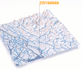 Places with similar names to Zinyawmaw, Myanmar ::
Disclaimer :: Information on this page comes without warranty of any kind |
||
|
Where is Zinyawmaw? Elevation and coordinates ::
Latitude (lat): 20°7'0"N Longitude (lon): 93°24'0"E
Elevation (approx.): -1m (map arrows pan, magnifying glasses zoom) |
||
|
Visiting Zinyawmaw? Hotel/Accommodation ::
Book a hotel in Zinyawmaw Travel Guide ::
Buy a travel guide for Myanmar rental cars ::
car rental offers GPS waypoint ::
download a GPX waypoint (PoI) of Zinyawmaw for your GPS receiver
|
||