|
search place name
|
||
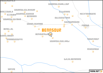
Ben Nsour (Tiaret, Algeria)Ben Nsour is a town in the Tiaret region of Algeria. An overview map of the region around Ben Nsour is displayed below.
regional and 3d topo map of Ben Nsour, Algeria ::
Ben Nsour airports ::
The nearest airport is TID - Tiaret Bou Chekif, located 59.3 km north east of Ben Nsour.
Other airports nearby include MUW - Ghriss (74.0 km west), QAS - Ech-cheliff Ech Cheliff (135.8 km north), TAF - Oran Tafaraoui (144.6 km north west), ORN - Oran Es Senia (155.6 km north west), Nearby towns ::
Et Tenia (0.6km south east) //
Beni Ouendjel (2.6km west) //
Douar Ouled el Hadj (3.6km south east) //
Aïn el Hadid (4.6km north west) //
El Maâizia (5.2km north east) //
El Ardja (5.8km north east) //
Douar Laghraba (6.2km north west) //
Ouled Sidi Yahin (6.8km north east) //
Sidi Nour ed Dine (7.5km north east) //
El Djenane (9.1km north east) //
Ben Amara (8.8km north west) //
Douar el Assaïlia (9.4km north east) //
El Mezaïlia (9.8km north east) //
[all distances 'as the bird flies' and approximate]  Places with similar names to Ben Nsour, Algeria ::
// Banasra (IQ)
// Ban Ai Su Rae (TH)
// Ban Sai Ra (TH)
// Ban Sai Ra (TH)
// Ban Sarai (TH)
// Ban Sarai (TH)
// Ban Sa Ri (TH)
// Ban Sari (TH)
// Ban Si-re (TH)
// Ban Sire (TH)
Disclaimer :: Information on this page comes without warranty of any kind |
||
|
Where is Ben Nsour? Elevation and coordinates ::
Latitude (lat): 35°1'59"N Longitude (lon): 0°55'50"W
Elevation (approx.): 1018m (map arrows pan, magnifying glasses zoom) |
||
|
Visiting Ben Nsour? Hotel/Accommodation ::
Book a hotel in Ben Nsour Travel Guide ::
Buy a travel guide for Algeria rental cars ::
car rental offers GPS waypoint ::
download a GPX waypoint (PoI) of Ben Nsour for your GPS receiver
|
||