|
search place name
|
||
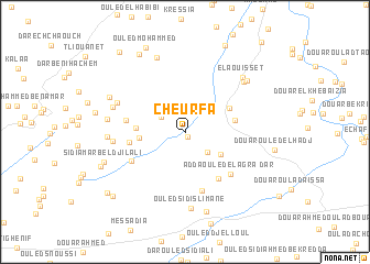
Cheurfa (Mascara, Algeria)Cheurfa is a town in the Mascara region of Algeria. An overview map of the region around Cheurfa is displayed below.
regional and 3d topo map of Cheurfa, Algeria ::
Cheurfa airports ::
The nearest airport is MUW - Ghriss, located 46.1 km south west of Cheurfa.
Other airports nearby include TID - Tiaret Bou Chekif (91.4 km east), TAF - Oran Tafaraoui (91.9 km west), ORN - Oran Es Senia (100.5 km west), QAS - Ech-cheliff Ech Cheliff (108.6 km north east), Nearby towns ::
Dar Ouled Kmicha (0.5km south) //
Douar el Habib Oued Kadda (2.7km south east) //
El Amarich (2.6km north west) //
Douar el Habib (3.7km south east) //
Dar Mohammed Ouled Taïeb (3.9km west) //
Rhelalfa (4.1km west) //
Douar Ouled Bouazza (4.4km north east) //
Douar el Menacir (4.3km east) //
Dar Adda Ouled Mohammed Ben Tahar (5.4km south east) //
Dar Ouled Taïeb (4.7km west) //
Abd el Kader Ouled Barhdad (6.0km south) //
Dar Ouled Toumi (5.1km west) //
Dar Adda Ouled el Agra (5.6km south east) //
Douar Ben Douha Ben Abdallah (5.3km south west) //
Dar Ben Ali (6.0km west) //
Douar Ouled Bou Douba (6.4km north west) //
Ouled Sidi Slimane (7.7km south) //
El Aouisset (7.0km north east) //
Douar Ben Ali Ouled Attou (6.5km north west) //
Dar Ouled Ahmed (6.5km west) //
Douar Ouled Della (6.5km west) //
El Aouïsset (7.3km north east) //
Ouled Bou Della (7.9km north) //
Douar Laâguerbia (7.3km north east) //
Ouled Ali Deniou (8.2km south) //
Douar Ouled Mohammed (7.2km north west) //
Sidi Amar bel Djilali (7.4km south west) //
Douar Ouled Mabrouka (7.7km south west) //
Dar Ouled Djilali (8.8km north west) //
[all distances 'as the bird flies' and approximate] 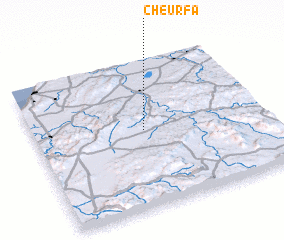 Places with similar names to Cheurfa, Algeria ::
Disclaimer :: Information on this page comes without warranty of any kind |
||
|
Where is Cheurfa? Elevation and coordinates ::
Latitude (lat): 35°31'16"N Longitude (lon): 0°28'50"W
Elevation (approx.): 298m (map arrows pan, magnifying glasses zoom) |
||
|
Visiting Cheurfa? Hotel/Accommodation ::
Book a hotel in Cheurfa Travel Guide ::
Buy a travel guide for Algeria rental cars ::
car rental offers GPS waypoint ::
download a GPX waypoint (PoI) of Cheurfa for your GPS receiver
|
||