|
search place name
|
||
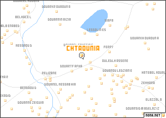
Chtaounia (Relizane, Algeria)Chtaounia is a town in the Relizane region of Algeria. An overview map of the region around Chtaounia is displayed below.
regional and 3d topo map of Chtaounia, Algeria ::
Chtaounia airports ::
The nearest airport is MUW - Ghriss, located 77.0 km south west of Chtaounia.
Other airports nearby include QAS - Ech-cheliff Ech Cheliff (79.7 km north east), TID - Tiaret Bou Chekif (90.3 km south east), TAF - Oran Tafaraoui (108.2 km west), ORN - Oran Es Senia (114.2 km west), Nearby towns ::
Douar Ouled Gana (1.5km south east) //
Douar el Goussine (2.2km north) //
Douar el Hemaïd (2.5km south) //
Douarel Aouaïss (2.6km south east) //
Douar Tfafha (3.4km south west) //
Douar Draïssia (5.8km north) //
Douar Ouled Yahia Ben Adda (5.4km south east) //
Douar el Djebabra (5.3km south east) //
Ferry (5.1km east) //
Douar Kriouat (6.3km south) //
Les Salines (6.1km north east) //
Douar Ouled Ali (6.5km south east) //
Douar Ouled Allel (7.5km south) //
Ouled Lhassene (6.2km east) //
Douar el Boualeg (6.5km south east) //
Douar es Slamnia (7.5km south east) //
Douar Zekahlia (8.4km south) //
Relizane (7.4km south west) //
Douar el Messabhia (8.0km south west) //
Douar Ouled Ziane (7.4km south east) //
Village Negre (7.7km south west) //
Douar Chouachia (9.1km south) //
Douar Ouled Mohamed (8.8km south west) //
Douar Meada (8.6km south east) //
Douar Rinaïzia (8.9km north west) //
Douar Lemssabhia (8.4km south east) //
Douar Ouled Mohamed (8.1km south east) //
Village Espagnol (8.2km south west) //
Siafa (9.2km north east) //
[all distances 'as the bird flies' and approximate] 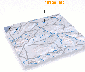 Places with similar names to Chtaounia, Algeria ::
Disclaimer :: Information on this page comes without warranty of any kind |
||
|
Where is Chtaounia? Elevation and coordinates ::
Latitude (lat): 35°46'52"N Longitude (lon): 0°37'33"W
Elevation (approx.): 61m (map arrows pan, magnifying glasses zoom) |
||
|
Visiting Chtaounia? Hotel/Accommodation ::
Book a hotel in Chtaounia Travel Guide ::
Buy a travel guide for Algeria rental cars ::
car rental offers GPS waypoint ::
download a GPX waypoint (PoI) of Chtaounia for your GPS receiver
|
||