|
search place name
|
||
Douar Charia (Chlef, Algeria)Douar Charia is a town in the Chlef region of Algeria. An overview map of the region around Douar Charia is displayed below.
regional and 3d topo map of Douar Charia, Algeria ::

Douar Charia airports ::
The nearest airport is QAS - Ech-cheliff Ech Cheliff, located 18.0 km south west of Douar Charia.
Other airports nearby include TID - Tiaret Bou Chekif (109.4 km south), ALG - Algier Houari Boumediene (161.1 km east), MUW - Ghriss (172.7 km south west), Nearby towns ::
Touadjine (1.1km north east) //
Douar Idouane (1.2km north west) //
Douar Abdeli (1.8km east) //
Douar Ouled Brahim (3.5km north west) //
Douar Touadjine (3.2km west) //
Abbaza (3.9km south east) //
Douar Ouled el Hadj (4.8km north) //
Bou Hniene (4.1km east) //
Douar Oukheite (5.1km south) //
Douar Louaradj (5.0km south) //
Zeboudja (4.6km north west) //
Ouled Bou Ali (4.9km north east) //
Bokat Habazane (4.8km south east) //
Douar Ouled Ziane (6.1km south) //
Ouled Allal (5.8km north west) //
El Ansser (6.1km south east) //
Douar Fossa (6.5km south) //
Ouled Kaddour Ben Chaoui (6.1km south west) //
Douar Tourria (6.6km north) //
Douar Cheikh Laraba (6.0km north west) //
Ouled Sidi Bou Zina (6.0km south west) //
Dʼhamnia (6.6km south east) //
Douar Bou Hamadi (7.1km south) //
Mechta Bou Taïeb (7.0km south) //
Douar Ahl Chaoui (6.8km south west) //
Hamlil (7.3km north) //
Douar Gʼni (7.2km north west) //
Douar Touatria (7.1km south west) //
Lehlalfa (7.5km south east) //
[all distances 'as the bird flies' and approximate] 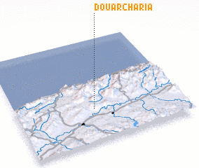 Places with similar names to Douar Charia, Algeria ::
// Darreh Shahr (IR)
// Darreh Shīr (IR)
// Darreh Shīr (IR)
// Darreh Shīr (IR)
// Darreh Shīr (IR)
// Darreh Shūr (IR)
// Darreh Shūr (IR)
// Darreh Shūr (IR)
// Darreh Shūr (IR)
// Darreh Shūr (IR)
Disclaimer :: Information on this page comes without warranty of any kind |
||
|
Where is Douar Charia? Elevation and coordinates ::
Latitude (lat): 36°19'36"N Longitude (lon): 1°28'28"E
Elevation (approx.): 597m (map arrows pan, magnifying glasses zoom) |
||
|
Visiting Douar Charia? Hotel/Accommodation ::
Book a hotel in Douar Charia Travel Guide ::
Buy a travel guide for Algeria rental cars ::
car rental offers GPS waypoint ::
download a GPX waypoint (PoI) of Douar Charia for your GPS receiver
|
||