|
search place name
|
||
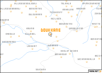
Doukkane (Algeria)Doukkane is a town in Algeria. An overview map of the region around Doukkane is displayed below.
regional and 3d topo map of Doukkane, Algeria ::
Doukkane airports ::
The nearest airport is ALG - Algier Houari Boumediene, located 51.6 km west of Doukkane.
Other airports nearby include BJA - Bejaja Soummam (120.1 km east), BSK - Biskra (262.6 km south east), Nearby towns ::
Dechra Djouara (1.5km east) //
Aomar (2.5km south east) //
Djebahia (4.3km south) //
Nezlioua (5.8km north) //
Beauprêtre (5.8km north east) //
El Djebel (6.0km west) //
Village Ben Tezerhrit (7.6km north) //
Kadiria (6.3km west) //
Tizi Gheniff (8.0km north) //
Lahguiat (7.1km south west) //
Ben Haroun (8.0km south) //
Ouled Amara (8.4km north west) //
Dechra Ikhelef (8.3km south east) //
Irhil Ou Ziane (9.5km north east) //
Irahalene (10.2km north east) //
[all distances 'as the bird flies' and approximate] 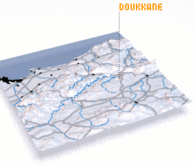 Places with similar names to Doukkane, Algeria ::
Disclaimer :: Information on this page comes without warranty of any kind |
||
|
Where is Doukkane? Elevation and coordinates ::
Latitude (lat): 36°31'0"N Longitude (lon): 3°45'0"E
Elevation (approx.): 361m (map arrows pan, magnifying glasses zoom) |
||
|
Visiting Doukkane? Hotel/Accommodation ::
Book a hotel in Doukkane Travel Guide ::
Buy a travel guide for Algeria rental cars ::
car rental offers GPS waypoint ::
download a GPX waypoint (PoI) of Doukkane for your GPS receiver
|
||