|
search place name
|
||
Oulad Abd el Aziz (Chlef, Algeria)Oulad Abd el Aziz is a town in the Chlef region of Algeria. An overview map of the region around Oulad Abd el Aziz is displayed below.
regional and 3d topo map of Oulad Abd el Aziz, Algeria ::

Oulad Abd el Aziz airports ::
The nearest airport is QAS - Ech-cheliff Ech Cheliff, located 26.4 km south east of Oulad Abd el Aziz.
Other airports nearby include TID - Tiaret Bou Chekif (120.0 km south), MUW - Ghriss (158.5 km south west), TAF - Oran Tafaraoui (177.2 km south west), ORN - Oran Es Senia (179.6 km south west), Nearby towns ::
El Mekaïn el Maloum (4.6km south) //
Oulad Fares (4.3km north west) //
El Mehadjer (4.5km east) //
Ouled Ben Kaddour (5.2km south east) //
Oum Tefrakh (5.4km north east) //
Tadjena (7.5km south) //
Abou el Hassen (6.4km north east) //
Bou Douanou (6.4km south east) //
Tertouchene (7.4km north west) //
El Kharrouba (8.1km north east) //
Bou Chitane (9.2km south east) //
[all distances 'as the bird flies' and approximate] 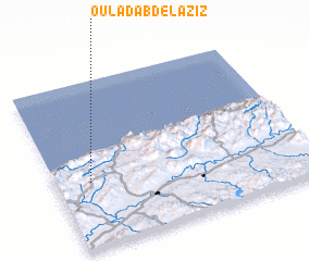 Places with similar names to Oulad Abd el Aziz, Algeria :: Disclaimer :: Information on this page comes without warranty of any kind |
||
|
Where is Oulad Abd el Aziz? Elevation and coordinates ::
Latitude (lat): 36°23'20"N Longitude (lon): 1°8'2"E
Elevation (approx.): 323m (map arrows pan, magnifying glasses zoom) |
||
|
Visiting Oulad Abd el Aziz? Hotel/Accommodation ::
Book a hotel in Oulad Abd el Aziz Travel Guide ::
Buy a travel guide for Algeria rental cars ::
car rental offers GPS waypoint ::
download a GPX waypoint (PoI) of Oulad Abd el Aziz for your GPS receiver
|
||