|
search place name
|
||
Ouled Bou Ali (Relizane, Algeria)Ouled Bou Ali is a town in the Relizane region of Algeria. An overview map of the region around Ouled Bou Ali is displayed below.
regional and 3d topo map of Ouled Bou Ali, Algeria ::

Ouled Bou Ali airports ::
The nearest airport is MUW - Ghriss, located 59.1 km south west of Ouled Bou Ali.
Other airports nearby include TID - Tiaret Bou Chekif (92.9 km east), TAF - Oran Tafaraoui (95.3 km west), QAS - Ech-cheliff Ech Cheliff (96.9 km north east), ORN - Oran Es Senia (102.6 km west), Nearby towns ::
El Khechaa (1.0km south west) //
Ez Zeraoula (1.5km south) //
Douar Ouled el Ahmar Ben Kaddour (1.3km east) //
Douar el Kedadra (1.6km north east) //
Tiliouane (2.0km south east) //
Douar Ouled el Ahmar (2.5km north east) //
Douar Ouled Adda (3.1km north) //
Douar el Moualil (3.1km north east) //
Douar Ouled el Aouda (2.9km east) //
Beni Yahi (3.6km south) //
Douar Rezeïguia (3.8km north) //
Douar Aoumria (3.7km south east) //
Douar et Touaïtia (3.4km west) //
Douar Ouled Ameur (3.8km south east) //
Douar Moualdia (4.4km south) //
Douar Ouled Srour (4.3km north east) //
Douar Djoualil (4.3km north east) //
Douar Mouasfa (3.9km north east) //
Kressia (4.2km south west) //
Khechab (4.0km south east) //
Djouibsia (4.4km north west) //
Douar Ouled Srour (4.6km north east) //
El Aouamria (5.5km south) //
Douar Sidi el Hadj (5.6km north) //
Douar Ouled Zid (5.5km south east) //
Douar Saïdia (5.3km east) //
Douar el Kouassem (6.1km south east) //
Ben Daoud (7.1km north) //
Mekadid (6.6km north west) //
[all distances 'as the bird flies' and approximate] 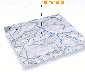 Places with similar names to Ouled Bou Ali, Algeria ::
// Oulad Bella (MA)
// Oulad Bou Ali (MA)
// Ouled Bell (MA)
// Ouled Bou Ali (TN)
// Ouled Béli (TD)
// Oulad Bella (MA)
// Oulad Bella (MA)
// Oulad Bou Ali (MA)
// Ouled Bou Ali (DZ)
// Oulataibli (CI)
Disclaimer :: Information on this page comes without warranty of any kind |
||
|
Where is Ouled Bou Ali? Elevation and coordinates ::
Latitude (lat): 35°38'56"N Longitude (lon): 0°30'40"W
Elevation (approx.): 121m (map arrows pan, magnifying glasses zoom) |
||
|
Visiting Ouled Bou Ali? Hotel/Accommodation ::
Book a hotel in Ouled Bou Ali Travel Guide ::
Buy a travel guide for Algeria rental cars ::
car rental offers GPS waypoint ::
download a GPX waypoint (PoI) of Ouled Bou Ali for your GPS receiver
|
||