|
search place name
|
||
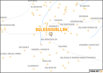
Ouled Sidi Allah (Mascara, Algeria)Ouled Sidi Allah is a town in the Mascara region of Algeria. An overview map of the region around Ouled Sidi Allah is displayed below.
regional and 3d topo map of Ouled Sidi Allah, Algeria ::
Ouled Sidi Allah airports ::
The nearest airport is MUW - Ghriss, located 23.1 km south west of Ouled Sidi Allah.
Other airports nearby include TAF - Oran Tafaraoui (78.2 km west), ORN - Oran Es Senia (88.4 km west), TID - Tiaret Bou Chekif (105.4 km east), QAS - Ech-cheliff Ech Cheliff (131.7 km north east), Nearby towns ::
Douar Oulad Sidi Ahmed Ben Ali (1.7km north west) //
Oulad Sidi Salem (2.3km south) //
Douar Sidi Abdallah (2.3km north west) //
Karaouat (2.8km north) //
Ouled Missoum (3.0km north west) //
Douar Alalma (3.4km north east) //
Douar Ouled Djilali (3.9km north west) //
Douar Ouled Adda (4.6km north) //
Douar ez Zaouïa (4.3km south west) //
Ed Dlaïlia (4.1km east) //
Douar Ouled Mohammed (5.1km north) //
Megaïdïa (4.8km north west) //
Ouled Larbi (5.2km north) //
Tighenif (5.3km north east) //
Douar Ouled Kadda (5.2km north west) //
Douar Krelaïlia (6.0km north) //
Ez Zaaïmia (5.2km north west) //
Ouled Sidi Mohammed ech Chergui (6.2km south) //
Douar Ouled Sidi Snoussi (5.3km east) //
Sidi Kada (5.8km south east) //
Maoussa (5.3km west) //
Aïne el Krarrouba (6.8km south) //
Ouled Snoussi (5.9km north east) //
Douar el Kedadra (6.7km south west) //
Ouled Sidi Safi (5.9km east) //
Sidi Mohammed Bene Zerga (7.5km north) //
Cacherou le Haut (7.6km south east) //
Douar Hamouïa (8.7km south) //
Douar el Araïssïa (8.6km north west) //
[all distances 'as the bird flies' and approximate] 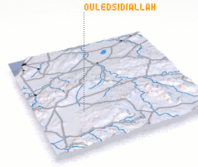 Places with similar names to Ouled Sidi Allah, Algeria ::
// Oulad Sidi Ali (DZ)
// Ouled Sidi Ali (DZ)
Disclaimer :: Information on this page comes without warranty of any kind |
||
|
Where is Ouled Sidi Allah? Elevation and coordinates ::
Latitude (lat): 35°22'20"N Longitude (lon): 0°18'13"W
Elevation (approx.): 489m (map arrows pan, magnifying glasses zoom) |
||
|
Visiting Ouled Sidi Allah? Hotel/Accommodation ::
Book a hotel in Ouled Sidi Allah Travel Guide ::
Buy a travel guide for Algeria rental cars ::
car rental offers GPS waypoint ::
download a GPX waypoint (PoI) of Ouled Sidi Allah for your GPS receiver
|
||