|
search place name
|
||
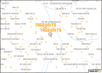
Tagounits (Algeria)Tagounits is a town in Algeria. An overview map of the region around Tagounits is displayed below.
regional and 3d topo map of Tagounits, Algeria ::
Tagounits airports ::
The nearest airport is BJA - Bejaja Soummam, located 62.6 km east of Tagounits.
Other airports nearby include ALG - Algier Houari Boumediene (104.9 km west), GJL - Jijel (134.9 km east), BSK - Biskra (235.0 km south east), Nearby towns ::
Irhil Igoulmimene (0.0km north) //
Taguemount (2.4km north west) //
Tagounits (2.4km north west) //
Taguemount (2.4km south west) //
Iguer Guedmimem (2.4km north west) //
Tafraout (3.0km west) //
Aït Ziri (3.5km south west) //
Afir (4.0km south) //
Tirzirt-n-Boubehir (4.3km north) //
Kharrouch (4.0km south east) //
Souama (4.8km north west) //
Tizi Guefres (4.8km south east) //
Haadouch (5.8km south) //
Igoufaf (4.8km north west) //
Aït Hichem (4.8km south west) //
Taka (4.9km west) //
Bel Resli (5.8km north west) //
Egreb (5.8km south east) //
Tabouda (5.8km south east) //
Aït Mellal (5.8km south west) //
Tarzoug (6.3km south east) //
Sahel (6.0km east) //
Aït el Mannsour (7.6km south) //
Agoussim (7.1km south east) //
Tazerout (7.3km south west) //
Aït Ali Ou Mohannd (6.8km south east) //
Aït Kheïr (7.0km north west) //
Irhil-n-Aït Tziboua (7.0km north east) //
Tifilkout (8.0km south) //
[all distances 'as the bird flies' and approximate]  Places with similar names to Tagounits, Algeria ::
Disclaimer :: Information on this page comes without warranty of any kind |
||
|
Where is Tagounits? Elevation and coordinates ::
Latitude (lat): 36°36'0"N Longitude (lon): 4°23'0"E
Elevation (approx.): 327m (map arrows pan, magnifying glasses zoom) |
||
|
Visiting Tagounits? Hotel/Accommodation ::
Book a hotel in Tagounits Travel Guide ::
Buy a travel guide for Algeria rental cars ::
car rental offers GPS waypoint ::
download a GPX waypoint (PoI) of Tagounits for your GPS receiver
|
||