|
search place name
|
||
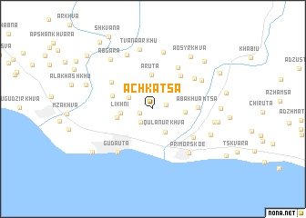
Achkatsa (Abashis Raioni, Georgia)Achkatsa is a town in the Abashis Raioni region of Georgia. An overview map of the region around Achkatsa is displayed below.
regional and 3d topo map of Achkatsa, Georgia ::
Achkatsa airports ::
The nearest airport is AER - Sochi, located 67.3 km north west of Achkatsa.
Other airports nearby include KRR - Krasnodar Pashkovskiy (242.2 km north west), STW - Stavropol Shpakovskoye (247.2 km north east), Nearby towns ::
Tsvishaarkhu (1.3km south west) //
Tsoukhva (1.3km north east) //
Abgavera (1.9km south west) //
Tamkvach-Igvavera (2.5km north west) //
Qulanurkhva (3.1km south) //
Bagikyta (2.9km east) //
Likhni (3.0km west) //
Aruta (4.2km north) //
Khapshira (3.4km west) //
Adzlagara (4.0km north west) //
Aualitsa (4.8km north east) //
Abakhuamtsa (4.1km east) //
Dzhgydyrkhva (5.5km north east) //
Ajimchʼighra (5.0km north west) //
Abgharkhukʼi (5.1km south east) //
Achandara (5.3km north east) //
Gudautʼa (6.2km south west) //
Tsvyndyrta (5.6km north east) //
Primorskoe (6.3km south east) //
Dzybzyr (7.1km north) //
Duripʼshi (7.1km north) //
Tvanaarkhu (7.3km north) //
Aatsʼi (5.7km east) //
Alra (6.0km south east) //
Aosyrkhva (7.2km north east) //
Abgara (7.2km north west) //
Aldzykh (6.1km east) //
Bintʼkha (6.1km east) //
Kvabryuta (7.5km north east) //
[all distances 'as the bird flies' and approximate]  Places with similar names to Achkatsa, Georgia :: Disclaimer :: Information on this page comes without warranty of any kind |
||
|
Where is Achkatsa? Elevation and coordinates ::
Latitude (lat): 43°8'30"N Longitude (lon): 40°40'16"E
Elevation (approx.): 125m (map arrows pan, magnifying glasses zoom) |
||
|
Visiting Achkatsa? Hotel/Accommodation ::
Book a hotel in Achkatsa Travel Guide ::
Buy a travel guide for Georgia rental cars ::
car rental offers GPS waypoint ::
download a GPX waypoint (PoI) of Achkatsa for your GPS receiver
|
||