|
search place name
|
||
Beniat'begoni (Abashis Raioni, Georgia)Beniat'begoni is a town in the Abashis Raioni region of Georgia. An overview map of the region around Beniat'begoni is displayed below.
regional and 3d topo map of Beniat'begoni, Georgia ::

Beniat'begoni airports ::
The nearest airport is MRV - Mineralnye Vody Mineralnyye Vody, located 227.9 km north west of Beniat'begoni.
Nearby towns ::
Bekot-Kari (0.4km south east) //
Gomurni (0.7km south) //
Mughure (0.7km north) //
Iukho (0.8km south east) //
Korogo (0.9km south west) //
Midelaani (1.1km south west) //
Sviana-Rostiani (1.3km south) //
Tskere (1.5km north) //
Ts'ikhiani (1.8km south) //
Sharumiani (1.8km south west) //
Sianami (1.9km south) //
Soncho (2.2km east) //
Zak'at'kari (3.0km south) //
Zhozhoni (2.7km south east) //
Kaishaurni (3.4km south west) //
Setʼurni (3.2km south west) //
Usharni (3.8km south east) //
Bedoni (4.5km south) //
Arakhvet'i (4.8km south) //
K'vemo Mlet'a (4.7km south west) //
Kʼumlistsʼikhe (4.0km west) //
K'veshet'i (5.0km south east) //
Zemo Mlet'a (5.0km south west) //
Lakat'khevi (4.9km south east) //
Sep'e (5.5km south east) //
Gudauri (4.8km west) //
(( Nizhniye Ganisi )) (5.5km south west) //
Kimbariani (6.0km south east) //
P'alagqau (5.7km west) //
[all distances 'as the bird flies' and approximate] 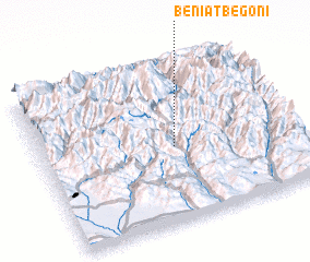 Places with similar names to Beniat'begoni, Georgia :: Disclaimer :: Information on this page comes without warranty of any kind |
||
|
Where is Beniat'begoni? Elevation and coordinates ::
Latitude (lat): 42°28'3"N Longitude (lon): 44°31'54"E
Elevation (approx.): 1788m (map arrows pan, magnifying glasses zoom) |
||
|
Visiting Beniat'begoni? Hotel/Accommodation ::
Book a hotel in Beniat'begoni Travel Guide ::
Buy a travel guide for Georgia rental cars ::
car rental offers GPS waypoint ::
download a GPX waypoint (PoI) of Beniat'begoni for your GPS receiver
|
||