|
search place name
|
||
Bogili (Abashis Raioni, Georgia)Bogili is a town in the Abashis Raioni region of Georgia. An overview map of the region around Bogili is displayed below.
regional and 3d topo map of Bogili, Georgia ::

Bogili airports ::
The nearest airport is AER - Sochi, located 229.5 km north west of Bogili.
Nearby towns ::
Bailet'i (2.5km south east) //
Naneti (2.2km west) //
Dziridzhumati (2.7km north east) //
Kela (3.2km north) //
Ninoshvili (3.6km north) //
Jumatʼi (3.1km north east) //
Guliani (3.4km north west) //
Chaniyeturi (4.3km south west) //
Akhalsopeli (4.5km south east) //
Silauri (3.8km east) //
Makharadze (5.3km south) //
Kirovi (5.6km north) //
Tsikhisperdi (5.8km south) //
Guriant'a (6.1km south) //
Chancheti (5.7km north west) //
Khvarbeti (6.0km south) //
Chinati (6.2km north) //
Etseri (7.2km north) //
Archeuli (7.1km north) //
Konchkati (6.1km south west) //
Khoreti (6.0km west) //
Oragve (6.9km north east) //
Kakhuri (7.9km south) //
Zedubani (6.3km west) //
Zemo-Chibati (8.6km north) //
Chʼochʼkhatʼi (7.1km north west) //
Juruqvetʼi (9.2km north) //
Nigvziani (9.1km north west) //
Meria (8.7km south west) //
[all distances 'as the bird flies' and approximate] 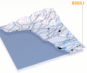 Places with similar names to Bogili, Georgia ::
Disclaimer :: Information on this page comes without warranty of any kind |
||
|
Where is Bogili? Elevation and coordinates ::
Latitude (lat): 42°0'6"N Longitude (lon): 41°57'19"E
Elevation (approx.): 57m (map arrows pan, magnifying glasses zoom) |
||
|
Visiting Bogili? Hotel/Accommodation ::
Book a hotel in Bogili Travel Guide ::
Buy a travel guide for Georgia rental cars ::
car rental offers GPS waypoint ::
download a GPX waypoint (PoI) of Bogili for your GPS receiver
|
||