|
search place name
|
||
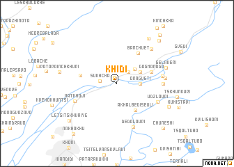
Khidi (Abashis Raioni, Georgia)Khidi is a town in the Abashis Raioni region of Georgia. An overview map of the region around Khidi is displayed below.
regional and 3d topo map of Khidi, Georgia ::
Khidi airports ::
The nearest airport is MRV - Mineralnye Vody Mineralnyye Vody, located 206.4 km north of Khidi.
Nearby towns ::
Gamogma-Noga (2.3km north east) //
Sukhcha (2.0km west) //
K'veda Gordi (3.1km north east) //
Oragveti (2.7km east) //
Zeda-Gordi (3.3km north east) //
Akhalbediseuli (4.8km south east) //
Gagma-Noga (4.5km north east) //
Bangveti (5.5km north east) //
Banchuet (5.5km north east) //
Kvaiti (4.5km west) //
Udzlouri (5.6km south east) //
Gordi (5.5km east) //
Mat'khoji (5.8km south west) //
Gvishtibi (5.5km east) //
Dedalauri (7.2km south) //
Dzedzilet'i (5.8km east) //
Rondishi (6.9km north east) //
Gelaveri (6.3km north east) //
Satsiskvilo (8.1km north east) //
Besiauri (7.2km south east) //
K'veda Kinch'kha (8.4km north east) //
Letsitskhvaiye (8.2km south west) //
Zeda-Kinchkha (9.2km north east) //
Chuneshi (9.1km south east) //
Nakhakhu (9.6km south west) //
Kinchkha-Perdi (10.1km north east) //
[all distances 'as the bird flies' and approximate] 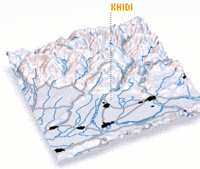 Places with similar names to Khidi, Georgia ::
Disclaimer :: Information on this page comes without warranty of any kind |
||
|
Where is Khidi? Elevation and coordinates ::
Latitude (lat): 42°25'0"N Longitude (lon): 42°30'0"E
Elevation (approx.): 493m (map arrows pan, magnifying glasses zoom) |
||
|
Visiting Khidi? Hotel/Accommodation ::
Book a hotel in Khidi Travel Guide ::
Buy a travel guide for Georgia rental cars ::
car rental offers GPS waypoint ::
download a GPX waypoint (PoI) of Khidi for your GPS receiver
|
||