|
search place name
|
||
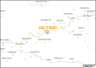
Kolitauri (Georgia)Kolitauri is a town in Georgia. An overview map of the region around Kolitauri is displayed below.
regional and 3d topo map of Kolitauri, Georgia ::
Kolitauri airports ::
The nearest airport is ERZ - Erzurum, located 190.3 km south of Kolitauri.
Other airports nearby include AER - Sochi (261.7 km north west), Nearby towns ::
Dzentsmani (0.7km north east) //
Pirveli Maisi (1.9km north west) //
Koromkhet'i (2.4km north east) //
Derekhokhna (3.4km south) //
Makhunts'et'i (2.9km west) //
K'veda Bzubzu (3.0km west) //
Ts'khemna (3.7km north east) //
Zeda Agara (4.4km north) //
Kvemo-Agara (4.6km north east) //
Zeda Bzubzu (4.9km south west) //
K'eda (4.8km north east) //
K'veda Makhunts'et'i (4.5km west) //
Zendidi (5.5km north east) //
Gulebi (5.2km north east) //
Zeda Makhuntsʼetʼi (5.1km west) //
Zundaga (5.6km west) //
Zesop'eli (6.2km north east) //
Ok'tomberi (6.3km east) //
Namlisevi (6.8km south west) //
Ak'uts'a (7.2km north east) //
Milisi (7.2km south west) //
Kʼokʼoletʼi (9.1km south) //
Ch'ik'unet'i (9.0km south west) //
Kʼveda Chʼkhutunetʼi (9.6km south) //
Zvare (8.8km north east) //
Varjanisi (9.2km north east) //
Tsʼkhemlisi (10.2km south west) //
[all distances 'as the bird flies' and approximate] 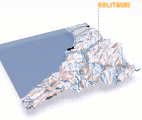 Places with similar names to Kolitauri, Georgia ::
Disclaimer :: Information on this page comes without warranty of any kind |
||
|
Where is Kolitauri? Elevation and coordinates ::
Latitude (lat): 41°34'46"N Longitude (lon): 41°53'38"E
Elevation (approx.): 468m (map arrows pan, magnifying glasses zoom) |
||
|
Visiting Kolitauri? Hotel/Accommodation ::
Book a hotel in Kolitauri Travel Guide ::
Buy a travel guide for Georgia rental cars ::
car rental offers GPS waypoint ::
download a GPX waypoint (PoI) of Kolitauri for your GPS receiver
|
||