|
search place name
|
||
Lesa (Georgia)Lesa is a town in Georgia. An overview map of the region around Lesa is displayed below.
regional and 3d topo map of Lesa, Georgia ::

Nearby towns ::
Zemo-Chibati (1.6km south) //
Kʼvemo Chʼibatʼi (1.3km east) //
Nigvziani (2.2km west) //
Chinati (3.8km south) //
Etseri (3.6km south west) //
Kirovi (4.4km south) //
Gvimralauri (3.6km east) //
Mach'khvareti (4.4km south east) //
Oragve (5.2km south east) //
Gvimbalauri (4.8km east) //
Juruqvetʼi (4.9km west) //
Ninoshvili (6.5km south) //
Lanch'khut'i (5.2km east) //
Archeuli (5.7km south west) //
Chancheti (6.7km south west) //
Jumatʼi (8.0km south) //
Dziridzhumati (8.0km south) //
Kela (7.5km south west) //
Nigvziani (6.8km west) //
Guliani (8.9km south west) //
Mamat'i (10.3km south east) //
[all distances 'as the bird flies' and approximate] 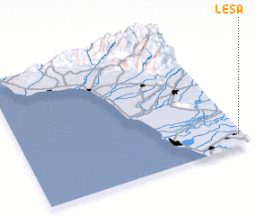 Places with similar names to Lesa, Georgia ::
Disclaimer :: Information on this page comes without warranty of any kind |
||
|
Where is Lesa? Elevation and coordinates ::
Latitude (lat): 42°5'25"N Longitude (lon): 41°58'45"E
Elevation (approx.): 10m (map arrows pan, magnifying glasses zoom) |
||
|
Visiting Lesa? Hotel/Accommodation ::
Book a hotel in Lesa Travel Guide ::
Buy a travel guide for Georgia rental cars ::
car rental offers GPS waypoint ::
download a GPX waypoint (PoI) of Lesa for your GPS receiver
|
||