|
search place name
|
||
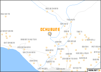
Ochubure (Abashis Raioni, Georgia)Ochubure is a town in the Abashis Raioni region of Georgia. An overview map of the region around Ochubure is displayed below.
regional and 3d topo map of Ochubure, Georgia ::
Ochubure airports ::
The nearest airport is AER - Sochi, located 90.9 km north west of Ochubure.
Other airports nearby include STW - Stavropol Shpakovskoye (238.8 km north), KRR - Krasnodar Pashkovskiy (257.5 km north west), Nearby towns ::
Amzara (3.8km south) //
Kaman (3.7km south east) //
Amba-Rykhutsa (4.5km south) //
Akhalsheni (3.6km east) //
Lenino (4.2km east) //
Guma (4.5km east) //
Agdara (6.1km south) //
Satave (5.3km north east) //
Zegani (6.3km south east) //
Shroma (5.7km south east) //
Adzigezh (7.0km south) //
Mtiskalta (5.4km east) //
Gorana (7.0km south) //
Uazabaa (7.8km south) //
Amba-Rykhutsa (6.2km west) //
Apianda (6.4km south east) //
Achʼadara (8.6km south) //
Verkhnyaya-Yashtkhva (8.3km south) //
Tsumuri (7.6km north east) //
Kaman (9.0km south east) //
Shitskvara (8.9km south west) //
[all distances 'as the bird flies' and approximate]  Places with similar names to Ochubure, Georgia :: Disclaimer :: Information on this page comes without warranty of any kind |
||
|
Where is Ochubure? Elevation and coordinates ::
Latitude (lat): 43°7'12"N Longitude (lon): 40°58'54"E
Elevation (approx.): 150m (map arrows pan, magnifying glasses zoom) |
||
|
Visiting Ochubure? Hotel/Accommodation ::
Book a hotel in Ochubure Travel Guide ::
Buy a travel guide for Georgia rental cars ::
car rental offers GPS waypoint ::
download a GPX waypoint (PoI) of Ochubure for your GPS receiver
|
||